Axis & Allies .org Forums
    • Home
    • Categories
    • Recent
    • Popular
    • Users
    • Register
    • Login
    1. Home
    2. Tjoek
    3. Best
    • Profile
    • Following 4
    • Followers 4
    • Topics 8
    • Posts 332
    • Best 49
    • Controversial 0
    • Groups 4

    Best posts made by Tjoek

    • RE: Introduce or Re-Introduce Yourself (Dec. 2018)

      Just like Quirky Turtle, greetings from the Netherlands. I played a few sessions of A&A back in the days of the MB version, but since the release of the 1940 games I wanted to get back into it. But somehow the copies didn’t leave their shelve since only 2 years ago when I started playing it together with Quirky Turtle and some other friends.

      We were heavily inspired by the strategy video’s from YG which really helped us in our learning curve from Allied favored to Axis favored. And the great customizations by many people from this great community. So I quickly jumped on to the biggest project of my live: retouching the big scanned map of Global 1940 that was already available to the community.

      Since then my hours put into this hobby has somewhat decreased but are still on a good level. With work on my own custom:

      • hit dice
      • tokens & markers
      • scanned version of the Anniversary Map
      • my own table top (not yet revealed yet)
      • web application to track your IPCs based on a GoogleMaps like interface of the 1940 map (and other versions of the AA family)

      Cheers,
      Tjoek

      posted in Welcome
      TjoekT
      Tjoek
    • Tjoek's A&A Anniversary OOB Map file (Updated March 23rd)

      Updated color enhancement, noise reduction and more cleanups
      LAST UPDATE: March 23rd 2019

      Hi all!

      It has been a while since I was active on this forum due to some personal struggles, but after seeing Young Grasshoppers video on the warped Anniversary boards I decided to step in and help the community to solve this issue. A couple of weeks ago I bought a second hand flatbed scanner which I modified to be able to scan large documents in multiple stages without the need of cutting the boards to pieces. This works great!

      A&A Anniversary OOB Maps

      I made 4 versions of the map (basically 2 versions and both with and without an IPC income tracker):

      • Standard out of the box (OOB) map
      • Same as above with IPC income tracker
      • Removed A&A artwork and replaced Italian roundels with correct ones
      • Same as above with IPC income tracker
        See below for the four corresponding map files.

      Please see my scan of the original game board with removed artwork and Italian Faces with 1/4 inch white border [400 dpi]:
      Download the A&A Anniversary with removed artwork and Italian Faces Map here
      preview
      NOTE: this file can be enlarged and can easily print up to 72 inch (250dpi)

      Same file as above but with an 1/3 inch white border and an 1 inch high IPC income tracker [300 dpi]:
      Download the A&A Anniversary with removed artwork and Italian Faces Map and IPC tracker here
      preview
      NOTE: if you scale this image the income tracker might look to big or to small. Just print it at 300 dpi which will result in a map 59.92 inch by 32.21 inch. Only then the tracker is 1 inch high

      Please see my scan of the original game board with 1/4 inch white border [400 dpi]:
      Download the A&A Anniversary OOB Map here
      preview
      NOTE: this file can be enlarged and can easily print up to 72 inch (250dpi)

      Same file as above but with an 1/3 inch white border and an 1 inch high IPC income tracker [300 dpi]:
      Download the A&A Anniversary OOB Map with IPC tracker here
      preview
      NOTE: if you scale this image the income tracker might look to big or to small. Just print it at 300 dpi which will result in a map 59.92 inch by 32.21 inch. Only then the tracker is 1 inch high

      Work done

      What I’ve done so far (bold and italic items are either new our revisited):

      • Scanned the brand new boards in multiple files in 400 dpi resolution (1/3rd high resolution then YG’s Global 1940 map)
      • Stitched the 9 best files per board in a graphical editor
      • Combined the 3 boards into one map and photo-shopped the borders between the 3 boards
      • Retouched some stitching miss alignments
      • Retouched the largest dust particles and printing errors on my map
      • Fully retouched and corrected all stiching errors and small scratches and dust particles
      • Enhanced the colours and contrast
      • Reduced scanning noise
      • Added a 1/4 inch white boarder
      • Replaced roundels with the same but more vibrant artwork
      • Version with Italian Fasces
      • Version with 60 IPC tracker
      • Exported to *.png image so no loss of details as with *.jpg to preserve the highest possible quality
      • Re-positioned Honolulu to the right location
      • Flipped Iwo Jima to the right orientation
      • Removed non existing ‘Atlantis’ islands south of Philippines
      • Centered territory names
        • Germany
        • France
        • Kiangsu
        • Stanovoj Chrebet
        • Baltic States
        • Rhodesia
        • Egypt
        • Poland
        • Bulgaria Romania
        • SZ 15
      • Renamed “Anglo-Egypt Sudan” to correct “Anglo-Egyptian Sudan”
      • Added SZ 66 name to the Caspian Sea

      Stay tuned for more customizations like home made hit dice, my Litko based flight stands and my continuation on cleaning the Global 1940 Map.

      But for now: Enjoy the map! And please let me know what you guys think of the map file and what could be enhanced or improved.

      Cheers,
      Tjoek

      posted in Customizations
      TjoekT
      Tjoek
    • Tjoek's Global 1940 setup charts: Updated Jan 31st

      Update:
      I’ve finished and corrected all the setup charts for both the OOB 1940 scenario as well as Larry Harris’ 1942 scenario. They can be downloaded in one ZIP file

      As my custom map use a few name changes to territories of both Russia and China, I’ve added the setup charts with the old names as well as the new names. So you can print what you like best.

      Enjoy!

      Note I’ve slightly updated the artwork such that the white letters now have a black border just as in the original artwork. 2 previews below:

      UK 1942

      US 1942

      ---------------------- Original message below ---------------------------
      Hi guys,

      Parallel on finishing my Anniversary map file and working on my custom roundels I started working on custom setup charts for Global 1940. I wanted to have custom setup charts to a few reasons:

      • I personally don’t like the wordy way the setup charts on the box are. I prefer table style layout so it becomes easy to spot how many of which unit type you’ll need
      • The global 1940 setup has a few minor changes compared to the setup on the boxes. This way we don’t have to double check the rule book for the minor changes
      • I will include a setup chart for the neutral territories (as I’ve removed the standing army number in my custom map file for Global 1940).
      • It becomes easy and straightforward to add the 1942 setup variant as well

      Inspired by the work of Siredblood I started designing with two design principles in mind:

      • the same look and feel as the original artwork of the game
      • should fit inside the original boxes that come with the game

      Once again shout out what you think about them! And let me know if things can be improved.
      Download Germany
      Germany

      Download Japan
      Japan

      Download UK
      UK

      Before I came up with these charts I worked on a system with one card per territory with visual clues to which units should be placed there. This will generate a lot of cards which I thought would be to cumbersome. But check it out for yourself anyway:
      Germany Territory

      posted in Customizations
      TjoekT
      Tjoek
    • RE: Merry Christmas 2018

      Same to you all! And may 2019 bring you a lot of victories (and at least fun games)

      posted in General Discussion
      TjoekT
      Tjoek
    • Tjoek's custom roundels and tokens

      UPDATE:
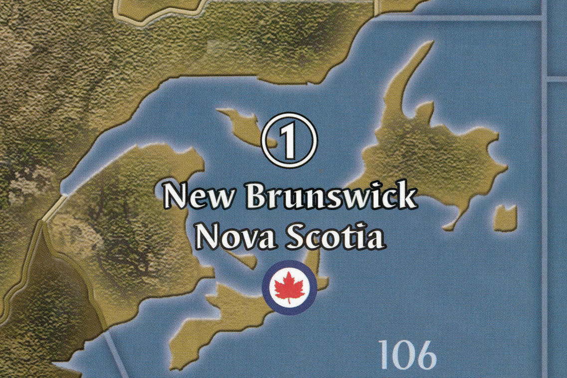
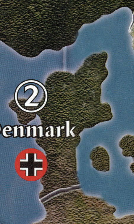
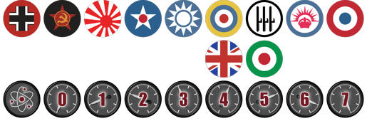
      Download link for the roundels. Click on image for larger version. These roundels are 19.4mm in diameter meaning you will have a 0.4mm cutting margin. For people that need the Pacific roundel or the Italian roundel as shipped with the game I’ve added these designs as well.

      ORIGINAL MESSAGE BELOW

      Hi All!

      After working on my Global 1940 map cleanup and my Anniversary map file it’s time to continue my customizations: Custom roundels and tokens!

      I never really liked the cardboard tokens that come with them game. Not because of the designs off the tokens, but rather the lack of weight and how easy you can pick them up from the board. I will create custom roundels and custom naval and air bases. And while I’m at it I can also work on custom movement tokens for airplanes and custom research / technology tokens.

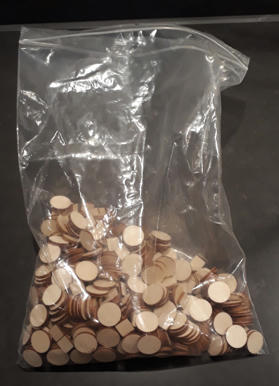
      To start this off I’ve ordered a laser cutting company to cut me 19mm (or 3/4 inch for those that go with the weird imperial units  :-P) discs and 12mm squares out of 3mm plywood. 550 discs and 115 squares to be more precise. More then enough to beef up my Global 1940 set (or any ww2 edition) as well as my 1914 set and some custom tokens as mentioned earlier.

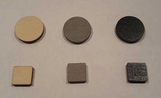
      Next stage is painting the wooden tokens. Fist one layer of primer followed by two layers of black paint. With a soft sanding before putting on each subsequent layer of paint. Roughly 40 discs and 10 squares done in the first batch so plenty more to do.

      Unfortunately my printer broke down the moment I wanted to print my first set of roundels to glue on top of the roughly 40 black discs I’ve painted so far. So it might take a few days for the new one to come in and for me to show some more progress.

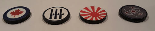
      As a teaser for what it will look like when finished, I’ve done a few prototypes a few months back. Each disc is finished with a home made print on high quality photo paper that’s glued on the disc. Subsequently the whole token is sprayed with a satin varnish to seal it and give it a nice but not too obvious shine. More importantly the varnish will protect it during game play use. Note my custom research token on the right. This will replace the research token in the Anniversary edition.

      And about the naval and air bases. They won’t get the same photo paper treatment… something 3D, but not a full miniature. Think more like a layered token.

      Stay tuned and let me know your comments, thoughts and ideas to make our game even better.

      posted in Customizations custom tokens
      TjoekT
      Tjoek
    • RE: Map of AAZ

      I’ve done multiple map files so far for Global 1940, Anniversary and 1914 (this one is WIP) and I’ve already started work on the Zombies map after my first game a few weeks ago.

      I’ve scanned the board and stitched the scans together. I’m currently slowly retouching the folds of the board pieces. I will post this first version as soon as it is ready in the Customizations subform.

      But for now the main focus is on finalizing the 1914 map first.

      posted in Axis & Allies & Zombies
      TjoekT
      Tjoek
    • Tjoek's A&A 1914 OOB Map file (Updated February 9th 2020)

      Hi All!

      After my maps for Global 1940 and Anniversary I started working on a cleaned version of the Axis & Allies 1914 map. I’ve been working on it on and off for about a year now and with some helpful feedback from this community as well as my local gaming group I finally finished it!

      A&A WW1 1914 OOB map files

      I made 2 basic versions of the map (one without and one with the harbours printed on the map). Both will have a replaced Sahara artwork as the original artwork was near impossible to fix in the fold line of the map running right across the Sahara, Next to that I will give you two small images you can add as an overlay to your own liking:

      • Unrestricted Submarine Warfare icon
      • Mobilization Zone
        See below for the 2 map files and 2 overlays:

      Map files

      Please see my scan of the original game board with removed harbours as well as removed Sahara artwork with 1/4 inch white border [400 dpi]:
      Download the A&A WW1 1914 with removed harbours and Sahara artwork here
      preview
      NOTE: this file can be enlarged and can easily print up to 52 inch (250dpi)

      Same file as above but with harbours [400 dpi]:
      Download the A&A WW1 1914 with removed harbours and Sahara artwork here
      NOTE: this file can be enlarged and can easily print up to 52 inch (250dpi)

      Extra overlays

      Unrestricted Submarine Warfare Icon
      Unrestricted Submarine Warfare Icon
      Mobilization Zone
      Mobilization Zone

      Work done

      What I’ve done with the map (bold and italic items are either new our revisited):

      • Scanned the map in 16 partly overlapping A4 scans in 400 DPI
      • Stiched the 16 individual scan together
      • Retouched the folds and creases of the map boards
      • Retouched scratches and dust particles on the map
      • Removed harbors (they are now optional on the map)
      • Replaced original Sahara artwork with cleaner version without logo, IPC tracker and Mobilization Zone
      • Extracted Mobilization Zone so it can be added back in if you like to
      • Repositioned Paris and Moscow to be more correct
      • Re-centering roundels, names and IPC values
      • Boost colors to be more vibrant as the scans are a bit dull (Colors are slightly warmer)
      • Reduced scanning noise
      • Replace roundels with high quality artwork
      • Replaced Bulgarian and Persian roundels with more correct ones from this period
      • Replaced Holland roundel with a bit more of the royal coat of arms
      • Reduced dark contrast between some territories and new artwork for the Sahara in Libya, Egypt and Anglo-Egyptian Sudan


      ==================== ORIGINAL FIRST POST BELOW ===================


      After my maps for Global 1940 and Anniversary I started working on a cleaned version of the Axis & Allies 1914 map. I’ve been working on it on and off for about a year now and I’m close to finishing it.

      What I aim for with this 1914 OOB map:

      • Map is based on high resolution scans of original map (400dpi) so it can be printed larger than normal. More than twice the size is possible.
      • The territory roundels, names and IPC values are often badly centered to one another as well as positioned within the territory itself
      • The way the Impassable Sahara is used for income tracking and unit costs is not to my liking, so I want to cleanup this area with a ‘cleaner’ artwork in style with the original
      • Personally, I prefer playing with my own harbor tokens so I will remove them from the board
      • I will replace the roundels with new high quality artwork to prevent any scanning noise from being visible in these details of the map
      • Reposition Paris to be more in line with where it should be
      • I aim to share on cleaned version of the map (replaces Sahara and removed harbors) as well as a more closer OOB version where these two items are not touched.

      Progress:

      • Scanned the map in 16 partly overlapping A4 scans
      • Stiched the 16 individual scan together
      • Retouched the folds and creases of the map boards
      • Retouched scratches and dust particles on the map
      • Removed harbors
      • Replaced original Sahara artwork with cleaner version
      • Reposition Paris
      • Re-centering roundels, names and IPC values (work in progress)
      • Boost colors to be more vibrant as the scans are a bit dull
      • Replace roundels with high quality artwork

      Sneak preview:
      Sneak preview

      Let me know what you think and how this map could be approved even further while staying close to OOB.

      posted in Customizations
      TjoekT
      Tjoek
    • RE: Original 1914 A&A map upsized?

      @Chacmool said in Original 1914 A&A map upsized?:

      @Tjoek

      Great news! If you need a scan of the map, I could help you. It is just a little stretched at one side maybe worth to look at it because I asume youve got the skills to fix it. I always wanted an oob map of A&A 1914.

      Thanks for offering your help, but I already scanned the board almost a year ago.

      So far I’ve stitched together the different scans and removed the folds and creases in and between the boards. Also I’ve retouched all the scratches and small dust particles in the scans.

      I’ve also replaced the Sahara with similar artwork but without all the IPC tracking and unit costs etc. I simply dislike my maps to be too busy. But that will be an optional download, I’ll provide both versions.

      At the moment I’m working on re aligning some of the territory names and roundels. After that I will enhance the colours and replace the roundels with high quality versions to prevent any scanning noise to be visible their on the final map.

      I should start a new tread…

      posted in Axis & Allies 1914
      TjoekT
      Tjoek
    • RE: ✅ Forum Migration To Do List

      @Quirky-Turtle said in ✅ Forum Migration To Do List:

      @djensen many thanks for all the hard work.

      I’ve noticed one minor bug. When logging in, the forum will not load the darkly skin but will keep the default until I go to settings and reset the skin there.

      The problem does not occur for me while the auto-login is still working (so when returning to the forum the skin remains to the one I’ve set)

      I have the same issue with not directly loading the dark skin when I login. After logging in a simple refresh will trigger the skin (less cumbersome then going to settings)

      posted in Website/Forum Discussion
      TjoekT
      Tjoek
    • RE: Tjoek's A&A Anniversary OOB Map file (Updated March 23rd)

      @vodot thanks mate! I’ll look into merging your fixes when I’ve got the time. Just started a new job which is consuming my time at the moment.

      Regarding Iwo Jima, if you go the route of fixing all the islands to their correct shape you’re doomed with the AA maps. Most of the islands are rubbish. Or simply don’t exist at all. Spot the two fake ‘Atlantis’ islands in the Dutch East Indies.

      posted in Customizations
      TjoekT
      Tjoek
    • RE: Axis & Allies .org 2020 Support Drive

      I’m in for bronze for the third year in a row! Great site with even greater community. I’ve been absent for nearly a year, but just posted my work in progress on the 1914 OOB map file. So I might be visiting more often again :-)

      posted in Website/Forum Discussion
      TjoekT
      Tjoek
    • RE: Tjoek's Global 1940 setup charts: Updated Jan 31st

      @8thGuards said in Tjoek's Global 1940 setup charts: Updated Dec 23rd:

      @Tjoek said in Tjoek's Global 1940 setup charts: Updated Dec 23rd:

      I’ve finished creating all the setup charts for both Global 1940 and 1942. See the first message for the ZIP file containing all files. This does include setup charts for the Neutral powers as well.

      Let me know if there are any errors.

      They look great!

      A few errors:

      ANZAC
      NSW minor factory (not major)

      Neutrals
      Persia 2 inf (not 3)

      Germany
      Poland tac (not ftr)

      Italy
      sz95 missing sub

      UK Europe
      France art (not inf)
      Scotland airbase (not naval base)

      UK Pacific
      India art (not mech)

      USA
      Midway/Wake/Guam each have airbase (not naval base)

      Thanks 8thGuard! I cannot believe I made this many mistakes. Knowing you I’m sure that everything you found are real mistakes on my part :-)

      Will try to fix them this asap.

      posted in Customizations
      TjoekT
      Tjoek
    • RE: Tjoek's A&A Anniversary OOB Map file (Updated March 23rd)

      Hi All,

      Somehow I was drawn towards this map once more and included a few more cleanups and enhancements. See first post for all details and new maps.

      Updates in short:

      • Enhanced colours preserving more details in the map
      • Correctly centred 10 territory names
      • Renames “Anglo-Egypt Sudan” to “Anglo-Egyptian Sudan”
      • Removed two non existing “Atlantis” islands south of the Philippines
      • More smaller things

      I hope you like it!

      posted in Customizations
      TjoekT
      Tjoek
    • RE: Should Pacific and Europe by Sub-categories?

      @djensen A logical choice! Keeps the forum nice and clean

      posted in Axis & Allies Global 1940
      TjoekT
      Tjoek
    • RE: ✅ Forum Migration To Do List

      @Panther Works fine now!

      posted in Website/Forum Discussion
      TjoekT
      Tjoek
    • RE: Original 1914 A&A map upsized?

      I’m working on a map file for 1914 based on the original boxed map. Just like my 1940 and Anniversary map files. I just didn’t open create a thread on the forums yet, but I’ve come a long way in stitching together the different individual scans and cleaning up the map folds and creases.

      Might take a few more months before it’s finished as time is very limited at the moment.

      posted in Axis & Allies 1914
      TjoekT
      Tjoek
    • Tjoek's 1940 Global Map file and setup charts (Updated May 30th 2018)

      Added first release of my map file

      LAST UPDATE: May 30th 2018

      A&A 1940 OOB Maps - Cleanest Version
      Tjoek’s 1940 Global Map file

      Here you can find matching setup charts for both the 1940 and the 1942 scenario.

      Cleanup

      • Removed all scratches

      • Fixed many issues on the map due to stitching the different scans together and/or the folding lines on the map (e.g. diagonal lines on neutrals didn’t run straight, borders where strange most noticeable in Switzerland)

      • Fixed issues on map due to artwork mistakes on the original board itself (e.g. water texture in Eastern United States, mirrored island in United Kingdom, Calcutta and Sidney now have a square capital marking instead of circle victory city marker, Malta didn’t have a shore, etc)

      • Removed adjacent to text on territories (as they are not needed in 2nd edition)

      • Enhanced contrast of most text

      • Balanced colors to hide seems between different scans, especially visible in the Pacific

      • Himalaya thicker stroke around text, similar to the other text on the map

      • Re aligned sea zone borders so that they are now lining up properly, so all lines run perfect vertical or horizontal

      • Re centered most of the sea zone numbers as well as the convoy and kamikaze markings

      • Re centered names of many territories like Denmark, Northern Italy, Mexico, Victoria, Urals, etc

      • Replaced all roundels with same but more vibrant artwork based of the vector images in the rule books

      • Aligned roundels to have equal vertical spacing with territory names

      2nd Edition changes

      • Yukon and British Columbia are merged into Western Canada

      • Added border between Alberta Saskatchewan Manitoba and Central United States

      • Added border between Quebec and New Brunswick Nova Scotia

      • Made Mexico longer to end at bottom of Sea Zone 10

      • Correct spelling of Palau

      • Correct spelling of Suiyuan

      • Removed ‘Burma Road’ name

      • French Equatorial Africa layout change so it is now in line with rest of the board (first line wider then second line)

      Enhancements

      • Removed standing army icons on neutrals

      • Re centered territory names of neutrals and changed Switzerland to the same font size as the other territories

      • Correct spelling of Chinese territories:

        • Anhwe -> Anhwei

        • Hopei -> Hopeh

      • Correct names of Russian territories:

        • Evenkiyskiy -> Yenisey

        • Yenisey -> Evenkiyskiy

        • Yakut S.S.R. -> Irkutsk

        • Timguska -> Tunguska

        • Volgograd -> Stalingrad

        • Samara -> Kuybyshev

      • Iwo Jima in right orientation

      • Honolulu in right location

      • Calcutta in right location

      • Removed big non existing island ‘Atlantis’ from Sea Zone 44

      • Replaced adjacent to text markings in sea zones with cleaner just numbers solution slightly enlarged since preview

      • Removed Mobilization Zones and Axis and Allies logos from both corners

      • Added Italian Fasces roundels

      • Territory/Sea Zone enlargements:

        • Bessarabia and re centered Western Ukraine

        • Gibraltar

        • SZ 110

      • Moved borders between SZ 108 and SZ 109 as well as SZ 118 and SZ 119 to the left to more clearly show SZ 109 and SZ Z119 are connected

      • Repositioned Stalingrad to not overlap with the border of the territory

      • Made Panama Canal a bit smaller so it looks more like a channel instead of an open sea

      ==================== ORGINAL FIRST POST BELOW ===================

      • The boards are first edition and don’t incorporate some small adjustments to the board that came with 2nd edition. Like Alberta & Central United States now sharing a border as well as Quebec and New Brunswick.

      • The original board had already seen tons of battles and as a result the digital scan shows battle scars and stains across the map.

      • Due to the difficult job of stitching together the different scans and seems in the board some malformation of territories, borders or names are present.

      posted in Customizations downloads
      TjoekT
      Tjoek
    • RE: 1942 3rd edition map thoughts

      @Black_Elk
      Dude! At first I thought you heavily added the map before I noticed it is just a horizontal flip…

      posted in House Rules
      TjoekT
      Tjoek
    • RE: Difference in start setup?

      The setups of both versions are definitely different. A quick search shows this file on BoardGameGeek:
      Play aids 1st and 2nd edition global

      I do think you need to have a BGG account to download the zip file. After extracting the pdf inside this zip file look for A&AG 1940 Play Aid Charts.pdf as this contains the setups and references for each nation for both 1st edition (in white) and 2nd edition changes (in yellow)

      posted in Axis & Allies Global 1940
      TjoekT
      Tjoek
    • RE: Original 1914 A&A map upsized?

      I’ve created a separate thread for my work on the OOB 1914 map. Please go here to discuss it in more detail.

      posted in Axis & Allies 1914
      TjoekT
      Tjoek
    • 1 / 1