Axis & Allies .org Forums
    • Home
    • Categories
    • Recent
    • Popular
    • Users
    • Register
    • Login
    1. Home
    2. Black_Elk
    3. Posts
    0%
    • Profile
    • Following 0
    • Followers 5
    • Topics 100
    • Posts 2,096
    • Best 184
    • Controversial 0
    • Groups 6

    Posts made by Black_Elk

    • RE: Working on a New Map 40/41: Seeking Suggestions

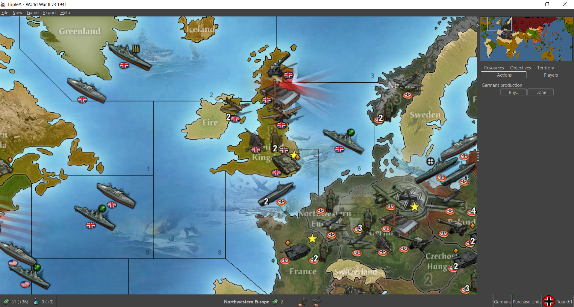
      Ok I gave Greenland another quick pass lol. It could probably be cleaned up more, but this is a draft blocking.

      TripleA_4k_working_25.png

      https://www.dropbox.com/s/7fwyake8wqyunco/TripleA_4k_working.png?dl=0

      The basic idea here is to build into a standard gamemap a certain degree of HR flexibility, beyond what we typically get, but for HR stuff that is more map oriented. You know making it somewhat easier for the player to adapt the map along different lines. Like for different start dates, or to add convoys, split a TT, make a spot impassible, or things of that sort. To make that sort of thing a bit more convenient to execute, without needing sharpies, or dry erase markers and laminate, or a background in design lol.

      The extra visual information is sort of just that, extra. Or at least for the normal A&A playscale. So it’s not like trying to make a new game that takes a month finish here, but rather to just give the player some options to build on, especially for the computer play. Whether they choose to utilize them, or how exactly, I don’t quite know, or at least not yet, which is why I posted it in this section.

      I just liked the way it carried as a visual design, because having some smaller regional tiles displayed in a subdued way seemed to reinforce what’s going on with the larger tiles, and I thought it looked cool hehe. But the germ of the idea was that it would be cool to have a mapboard that could do double duty in some fashion. I’ve been building thus far with tripleA in mind, because the concept is somewhat more versatile there and fills a certain niche, but I thought it might have promise for a physical game as well. Clearly it’s a WIP, but I wanted to share in case anyone has some ideas.

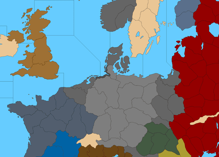
      Here’s a more ‘Revised’ looking one, with the super dark oceans… lol

      TripleA_4k_working_dark_blue_25.png

      I like to switch the SZ colors like that between the two extremes while working, to hunt down rogue floating pixels that got left behind while I tooling around with the pencil. For the subdivisions the thought would be to reduce the opacity there, so that they’re still visible, but more backgrounded. It’s just easier for me to work with Black and White in the draft, and also because that’s how tripleA parses the bitmap before loading the reliefs, which is why the look is more basic here.

      I cropped the Antarctic, and slightly widened the Atlantic and Pacific oceans so the aspect ratio would be closer to 2:1. I think that should give better room for the G40 division which could be slightly reshaped now, so that would be my next step. Like up in the North Atlantic around Greenland, since I won’t be able stop thinking about that forever now lol.

      The arctic ice sheet is just sorta an expedient for my quick paint bucket, but an idea for tripleA would be to draw it such a way that certain sz tiles get painted over in ice every other round say. Like so you can only get to Murmansk when the weather permits or stuff of that sort. Again, rough blocking, I think it could certainly be cleaned up hehe, but that was sort of the idea behind extending those sz tiles at the top of the board.

      Of course we still get that dead space in the southwest Atlantic and southeast Pacific, but I guess that’s where you’d stick a compass rose or key or whatever right hehe.

      For reliefs, I’d like to try one that is more topographical and one more political/balance of power painted colors, that could be changed on the fly.

      Or in the physical analog to have the Front side of the board show one type of relief and the Reverse side of the board show another. So one could have a display that’s more modern terrain style, and another that’s more classic mappy. Just seemed like that would be trick. For the digital game you do more than 2 options there, with map relief skins loaded up to service different styles or gameplay ideas.

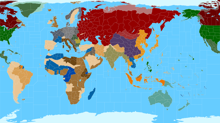
      In tripleA if you turn off all the map reliefs/details, you get something more barebones in the look, sorta like this. But I’d like to still look at least halfway decent that way, for the ultra stripped down skeleton hehe.

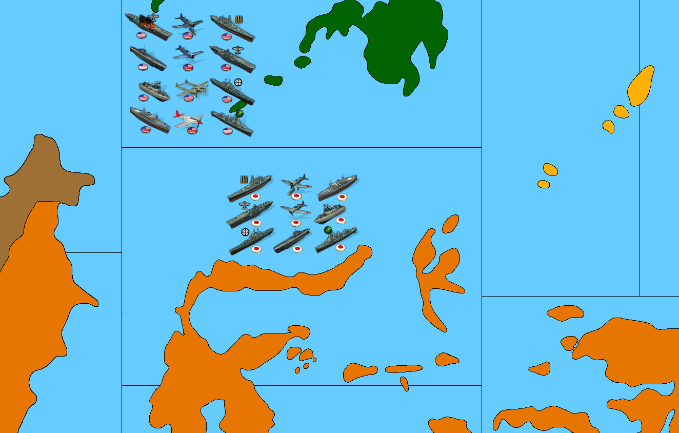
      So far I’ve been just kinda winging it with the sea zone subdivisions, but an idea I thought might be cool was to divide each SZ tile in half, or at most 4 quadrants maybe. Say Alpha Beta Gamma Delta, just cause that sounds cool and reminds me of Star Trek lol, like for a tripleA game that’s all super zoomed in that way. But perhaps it could be used to explore a different kind of naval game on the actual board too? Like if you could use the same larger G40 tile, but maybe put a chip or roundel to indicate the exact Quadrant for different stuff. Maybe a convoy system more like the older Europe and Pacific games added back into it somehow, or some new thing with subs, or some kind of staged carrier battle. I don’t really know honestly, still kinda hazy there, but it seemed like it might be worth exploring. So that’s sorta where I’m at with it.

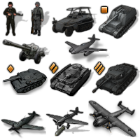
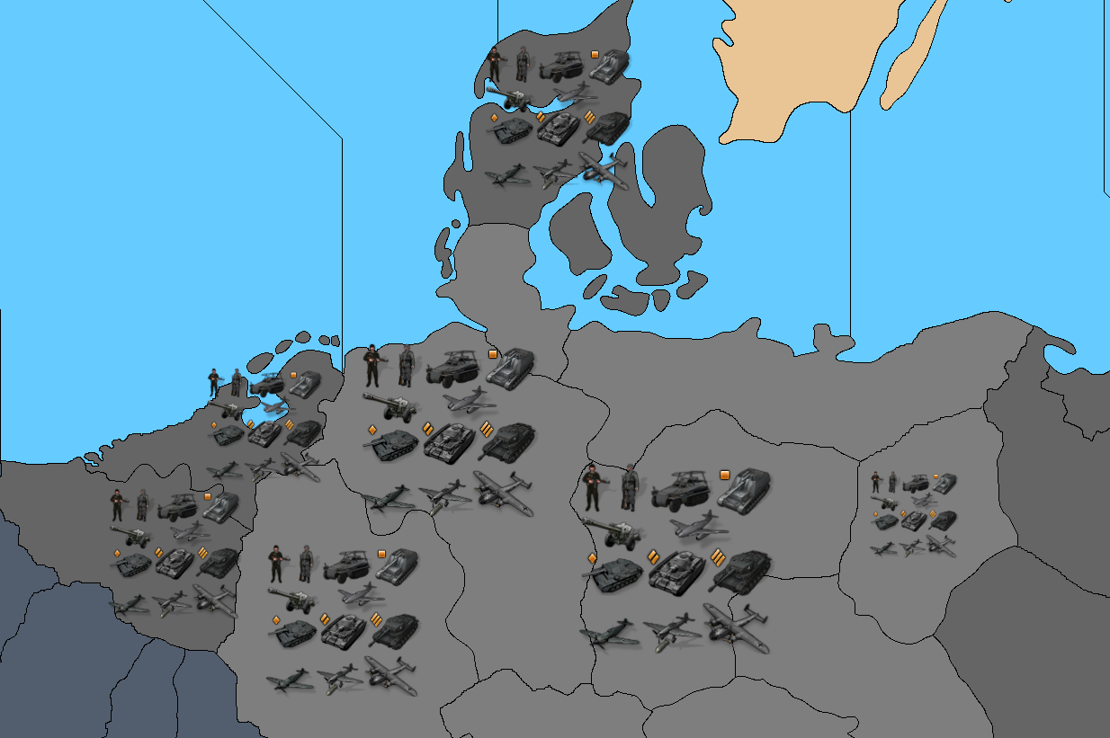
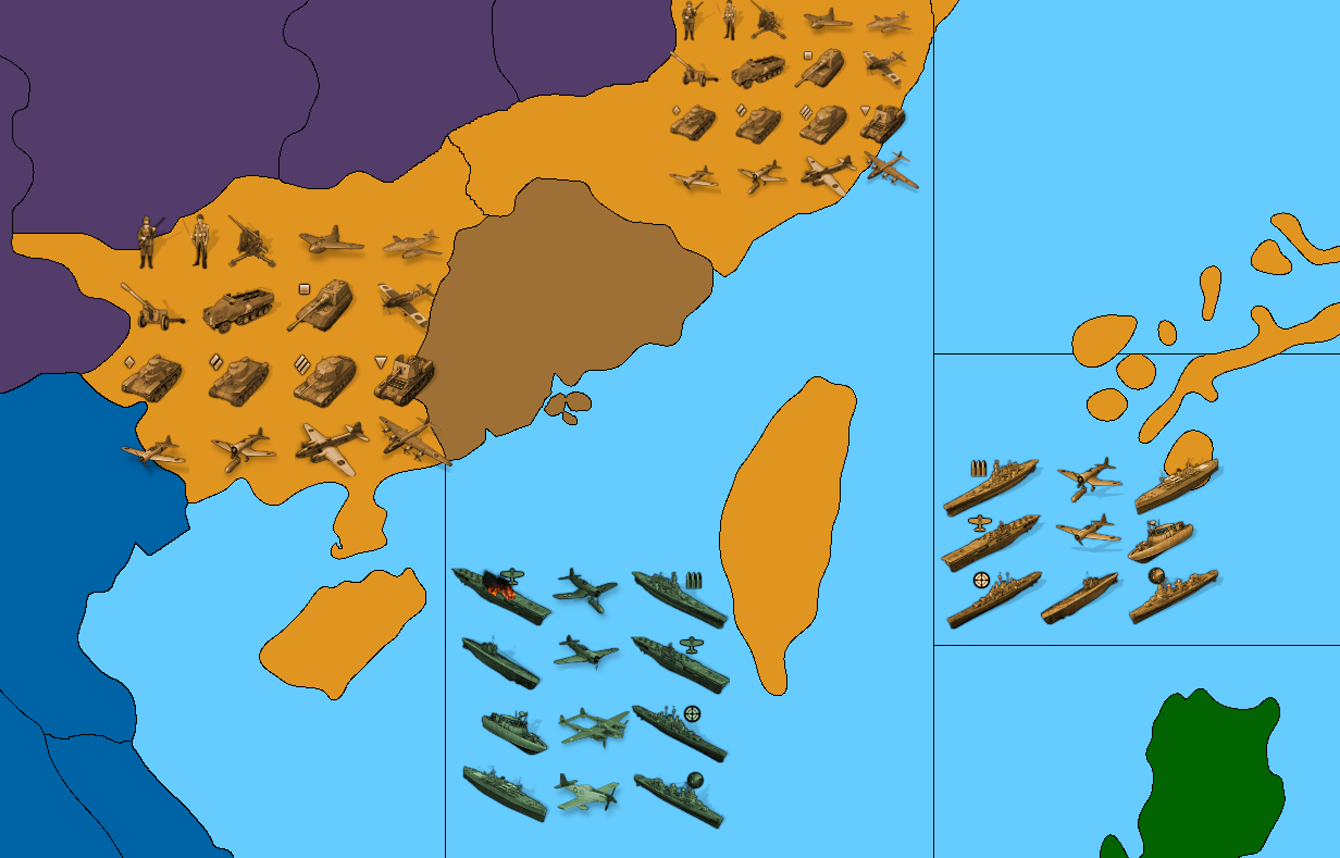
      Here it is with some more of the micromachines at various scales…

      The idea is to have the national painted units that Frostion created which are larger at 54px than the standard units at 48px - But then also a colorized tint version of the same.

      Basically so the player can choose their own colors for Units the same way they can for the map ownership colors, by just selecting a HEX color code in the map.properties. This would be cool I think for people who have different aesthetics preferences or also for the colorblind, where you could assign the color values based what’s easier to see, or just more pleasing to the eye. Which tends to very person to person.

      colorized.png
      example-units-scale.png japan.png
      ussr units.png
      Brits.png

      I’ll post again in a week or two when it’s further along.
      Catch ya next round!

      a00f2cd6-a44c-4584-a56b-d25fecf88d2b-image.png

      ps. here it is with some more corrections and enlarged G40 sea zones. I changed the geometry where I thought I could away with it, to prioritize the coastal sz tiles over the transit sz tiles. Hopefully should work a bit better for housing the ships.

      TripleA_4k_working_sea_zones_25.png

      posted in House Rules
      Black_ElkB
      Black_Elk
    • RE: Axis & Allies Global 1964

      @the-captain Oh damn! I never read the book, but I did see the HBO flick with Rutgar Hauer in the mid 90s hehe. It had a good set up in the intro, playing the film reels, but with an alternative narration. Failed D-Day as the premise right? And then everything going to hell after. Seems like a potentially interesting scenario. Like that one and the Man in the High Castle both work a similar “what if” angle. I always thought A&A in 1942 was a bit like ‘what if Japan had won at Midway’, cause like Charlton Heston and Henry Fonda couldn’t get the job done, and that explains why Japan is all Globe trotting in the endgame lol. That would be like my head cannon to explain what’s happening on J1 in 1942.2.

      For a PvP game you never really get the chance to see it unfold, but in SP vs the AI in tripleA, the endgame of virtually every WW2 map can go like Alexa Davalos straight through the portal into Invasion USA lol. Like that boardgame Amerika right, but with a Global map instead of just North America I guess? Seems like it could be cool!

      posted in Other Axis & Allies Variants
      Black_ElkB
      Black_Elk
    • RE: Working on a New Map 40/41: Seeking Suggestions

      @imperious-leader

      Thanks for the feedback. I think you’re mixing up the digital draft templet with what it’s intended to turn into lol.

      The idea was to provide a bunch of lines that could be erased for that.

      I mean did you see the G40 one?

      TripleA_4k_G40_painted_25.png

      The crazy TT SZ subdivisions of the other baseline draft obviously would not work for a physical A&A game, or for anything outside of tripleA really. It’s meant to be broken down with smaller tiles collapsing into larger tiles. Or with those smaller divisions being retained purely as design elements. In tripleA the player/designer may wish to create a scenario that is more like a total war game or intended for a single player vs an AI and stuff like that, but that’s more for digital games where the unit sculpts can be scaled and the map view changed dynamically. For a physical mapboard you’d need to prioritize a more normal playscale with normal sized sculpts and normal TT sizes to house them. But even there, if one wanted to say split a particular TT or SZ in half or change it’s shape, that there would be some lines and contours in place to serve as guides for that. So the map creator could choose what to include and (more importantly) what to omit haha.

      Here is a quickie visual to help clarify the gist of what’s going on…

      detail.png

      The white lines there show an example of some actual TT divisions, like for an actual game at a G40 scale. The black lines simply provide guides for how those territories could be drawn, or further subdivided, if one wanted to say add another tile in France or on the Eastern Front or wherever, or include another sz or convoy zone somewhere, to recast the shapes and make a given spot larger, or simply for flavor to provide some visual design interest when creating reliefs from them hehe.

      You know like where the black lines would be knocked back or made less opaque as a transparency, or removed entirely where extraneous, stuff of that sort.

      Part of the reason I approached it in the way that I did, was to give a templet that could service different timelines or start dates as well as different playscales, which might recommend different TTs or differently shaped TTs, so it could be more adaptive in that way.

      But the actual look of the thing, when all is said and done, may look less like that, and much more like this… Just cleaned up, and at 16000px, for a G40 scale - rather than AA50 at 3700px, which is what you’re seeing below.
      :)

      tripleA.png

      ps. Thanks for the Greenland Godzilla dig too! lol
      I’m sure I’ll get around to fixing it eventually hehe

      Happy Halloween!!!
      ;)

      posted in House Rules
      Black_ElkB
      Black_Elk
    • RE: Working on a New Map 40/41: Seeking Suggestions

      Here’s an idea for how to do Germany…

      So the dark strip TT there maybe allows aircraft to pass over, or for ships to be produced into the adjacent sz, but prevents amphibious landings directly into Saxony and such?

      G_detail.png

      Or not heheh
      This is probably simpler…

      TripleA_4k_Domination_1941_draft_25.png

      Here it is at 16000px

      https://www.dropbox.com/s/qc3xgrbtqp55gt6/TripleA_4k_Domination_1941_draft_1px_borders.png?dl=0

      Some example German digi-sculpts using the Frostion units.

      German_units.png German Units Scaled.png

      That detail shows the digital sculpts at at various scales. So like Saxony is displaying units at 100%, Berlin at 110%, Belgium 75% etc. Just to give a sense for the possible playscales.

      I like 75%-87.5% for the units/centers with a map at this size and all super divided up lol. 110% or larger would be better for Global.

      posted in House Rules
      Black_ElkB
      Black_Elk
    • RE: Working on a New Map 40/41: Seeking Suggestions

      Here it is with white borders…

      TripleA_4k_Domination_1941_painted_med_channel_white_light_25.png

      Here it is with oceans in darker blue, with the white border lines. In case people prefer a more revised style presentation for the ocean/sz color

      TripleA_4k_Domination_1941_painted_med_channel_white_25.png

      The perception of any given color will change quite a bit, just based on the value/vibrancy of colors surrounding it, which going from light blue oceans to dark blue oceans highlights pretty clearly. I only changed one color in isolation there, between those two images, but of course doing that, our perception of everything changes in relation haha. So one might prefer a few different shades/HEX colors for the various player-nations, depending on whether they like a lighter read or a darker read, overall, for their map aesthetic. But just to give an example

      Best Elk

      posted in House Rules
      Black_ElkB
      Black_Elk
    • RE: Working on a New Map 40/41: Seeking Suggestions

      TripleA_4k_Domination_1941_painted_med_channel_25.png

      Just did laid down lines where I thought they might be interest. In general the idea was to create some interesting around the islands and to give more places for ships to go, line if including sz cash in the form of convoys for transit lanes and such. The smallest sz tiles here can fit about 18-24 units with the digital sculpts at 54 px, so just to give a sense. I got about half way around the board, before trying to decide whether to split Celebs on the vertical or the horizontal, so I thought I’d pause and take stock heheh

      https://www.dropbox.com/s/tugjcvsb5y106rl/TripleA_4k_Domination_1941_painted_more_sz.png?dl=0

      fe91fcca-df7c-4096-8e57-5692ac83282f-image.png

      Celebs_Pacific_detail.png

      posted in House Rules
      Black_ElkB
      Black_Elk
    • RE: Advice to Renegade! What is on your top 10 for adjustments to G40 3rd edition?

      Right on! :)

      posted in House Rules
      Black_ElkB
      Black_Elk
    • RE: Working on a New Map 40/41: Seeking Suggestions

      @the-captain Thanks!

      I’ll get back in the kitchen on it tomorrow to make sure the connections are all correct haha. I think my eyes were starting to blur over towards the end there, as I nearly entered the matrix and all the sea zones started looking like skynet circuits heheh

      Great ideas!

      I got Barney making the list for stuff to fix up for the next pass. All the tricks and treats lol. Keep em coming!

      Catch ya next round!

      ps. Tried to work the lines, but I might have missed a few. Will take another pass over the weekend.

      Still needs some clean up in a few spots. Was thinking for the sea zones to have those subdivision bisecting islands when possible to make them more interesting. So for say for the costal sz off Morocco maybe get broken into 2 or 3 tiles so it can hit across Canaries or Azores. Have Bermuda riding a line and Malta, stuff like that. Basically the smaller tiles in either ocean can fit about 18-24 units at 54px, so that could be the scale I think. Playing the regular global game those units could probably upscale a bit more.

      posted in House Rules
      Black_ElkB
      Black_Elk
    • RE: Working on a New Map 40/41: Seeking Suggestions

      With a G40 style blocking

      TripleA_4k_G40_25_percent.png

      https://www.dropbox.com/s/1j7omf0s69t1r3k/TripleA_4k_G40.png?dl=0

      TripleA_4k_G40_painted_25.png

      posted in House Rules
      Black_ElkB
      Black_Elk
    • RE: Working on a New Map 40/41: Seeking Suggestions

      Sounds rad! Just tried to work up some sea zones and clean up a few tiles. I think it’s coming along now.

      Here it is with some quickie naval units for the vibe…

      The hope is to get something looking good with Frostion’s units since they’re a bit larger

      triplea_4k_baseline_g40_subdivisions_sz_ships_100.png

      Ships there are around 72 px.

      With some extra fighter aircraft I threw together showing tech tech advances for LR and such. Just to get a sense for how it would fill out there with a bunch of units at once.

      Ideally the units could be upscaled a bit, but my goal is to avoid a bunch of clipping and to have stuff fit nice and comfy.

      Here’s the larger map with some more of the Atlantic added in, and the tiles in Central and Eastern Europe cleaned up a bit…

      TripleA_4k_baseline_G40_subdivisions_sz_25.png

      Here’s the big bitmap showing the same at 100%, before I hit the hay lol

      https://www.dropbox.com/s/6wdj4i1rcka8y99/TripleA_4k_baseline_G40_subdivisions_sz.png?dl=0

      Anyhow, that’s where we’re at right now. Will crack into it some more tomorrow. Catch ya in a few!

      Best Elk

      posted in House Rules
      Black_ElkB
      Black_Elk
    • RE: Working on a New Map 40/41: Seeking Suggestions

      @the-captain Badass!!! Revised has a special place in my heart for sure! I love the detailing there on the one you just posted! I’d love to do a few different reliefs for different styles at some point. One sorta Classic and ‘mappy’ looking, one more like the Topo reliefs from the more recent boards, maybe a darker one too in case people like the deeper blues for the Sea Zones.

      Here is the same map but with the oceans done in Navy Blue, in case anyone likes the more Revised style callback… I isolated and removed all the divisions except for the ones displayed in Global 1940, shown as 1px black line.

      At scale it’s 16000px but here it at 25% view, for readability on these forums. I paint bucketed that Arctic ice sheet to be blue there, just for the cleaner read in the 3 color, or if one wanted to use that space in other ways. I kept the dividing line, just painted slightly differently than the earlier posts, cause the ice sheet thing only really looks good once the map is painted out in fuller colors haha.

      TripleA_4k_baseline_G40_example_navy_25.png

      This bitmap I’ve been working up is at a 16:9 aspect, but I tried to make it in such a way that one could slide the continents a bit if one wanted to make larger oceans say. I was trying to iron out the kinks as a raster, but then the thought was to get a pull in inkscape and save it out as an svg so it would be easy to upscale/downscale or warp as desired from a vector rather than a raster image.

      Here it is as an svg of the simple baseline, in case you like to play around with it in inkscape or illustrator. In those programs it’s much easier to score the lines at the desired width, or warp and manipulate the map for uses outside tripleA. Like if one wanted to print it for an actual gametable, probably would want to crop the Antarctic, then extend the warp more vertically, or stuff of that sort, which is a bit easier to do in vector. It doesn’t have any sz included yet, cause I figured people might like different designs. Or if they wanted to use the same world projection but do AA50 borders rather than Global borders, or original borders of their own devising heheh.

      https://www.dropbox.com/s/ehcnfkr28llq8gg/TripleA_4k_G40_vector.svg?dl=0

      If you’d like to make use of it in any of your customization projects, feel free! I made it for us, and for the future! heheh

      Here is the development thread at tripleA, in case anyone likes to see the design process thus far, or check out the conversations which brought us to this point. I’ve been posting almost daily revisions, trying to work in feedback from the gang.

      https://forums.triplea-game.org/topic/3315/proposed-map-domination-1941

      All the best
      Elk

      ps. here’s where I’m at right now…

      https://www.dropbox.com/s/fbpnc3q4ccjrgqr/TripleA_4k_baseline_G40_subdivisions.png?dl=0

      For a visual/aesthetic preference, I prefer the land TT colors to be more mid-tone in values and the sz lighter, or else land lighter in value and sz more mid-tone. Basically just to get some contrast going between land and sea. In tripleA one can play with the HEX in map properties to change the colors, but just sort my hard and fast for sz. Something like this…

      TripleA_4k_baseline_G40_subdivisions_25.png

      Or something like this…

      TripleA_4k_baseline_G40_subdivisions_navy_25.png

      More or less. Just for the quick read, depending on whether one likes darker or lighter oceans, ie more Classic style vs more Revised style I guess heheh. I pushed the grays there to be a little more extreme than 50% either direction just to show, although usually I’d say land at 50% gray in value is what people tend like for the player nations (around that value range just with the saturation/hue tweaked depending on the player nation’s color). It really works best if Axis are at say 60% color value and Allies are 40%, or just that there’s enough value variation there so when they pair off adjacent it looks cleaner on the quick read. That’s more for like standard default colors in tripleA (which can be changed in map props) but for the sz color value I think one needs to do that in the baseline/relief. At least for the basic values I mean, since you can change that with reliefs to some extent by messing with the opacity/saturation in layers, but I like the idea that if all map details were turned off that it would still look good.

      I if think if we go dark sz, then having brighter ships is good for the units, or vice versa for the ground units. Just depending on how dark or light one goes with the color values for either.

      Ideally the player would be able to choose from some kind of display setting for some of that stuff, but I think the way it works in tripleA, we need two different reliefs or map skins to pull it off.

      I’d probably do the same for White borders vs Black borders style, cause I think that’s another thing people might enjoy having control over. Couple different decorative motifs would also be rad. Basically so you could trick out your digital board to look more like your fav physical boards. That’d be the goal, cause that just seems cool as all get up to me! haha

      Basically so you could select a prefered style for SZ color and border boundaries, and then get a choice for more Topographic relief or more Decorative/Political relief, as like as a mapskin choice. That would be pretty clutch

      posted in House Rules
      Black_ElkB
      Black_Elk
    • RE: Advice to Renegade! What is on your top 10 for adjustments to G40 3rd edition?

      So the Q was for Global 3rd Ed, but while we’re at it… I just got 3 to add

      1. A legacy version of the base game (midscale board), that is simply called “Axis and Allies” ie don’t include a start date year or an edition number in the name for that one. It should present as the basic starter set. Provide unit set ups for a couple dates like AA50 did, but do that in the manual instead. The idea being that it’s easier to re-print or revise or download material for unit set ups in a manual than on cards/boxes. So you could do 1942 as the default, but also 1941 or 1943 say, just by referencing a page in the rulebook.

      2. Axis and Allies Global - Sell it as a single complete game, rather than 2 separate theater games. For packaging maybe have 1 box be for the maps the cards and all the paper stuff, and then have units sold separately? I think the players that are most interested in the more advanced game just want G40, rather than Europe and Pacific 1940. By selling the sculpts separately there is less need to divide the boards by theater, and then it can build on the starter unit set included with the base “Axis and Allies” game mentioned above.

      3. Include a small Art book/History of the Axis and Allies game and it’s creator, including the images from all the cover boxes and such. Legacy style! I just think that would be a nice touch and cool to see.

      posted in House Rules
      Black_ElkB
      Black_Elk
    • Working on a New Map 40/41: Seeking Suggestions

      Hey what’s up gang! It’s been a while!

      I had a request to design an updated tripleA map for use at 16000 px, so I’m trying to pull off a projection that could also work for G40, or alternative timelines for games at that scale, using the more traditional territory tiles and boundaries.

      I’m about half way through the process, so you’ll have to forgive some of the oddballs here. I’m still working on defining the TTs, but I just wanted to gather some feedback if possible, and to find out what’s working (or not) on the quick read haha. It’s based on my earlier projection for V3, with an original warp on the world that I devised to suit my preferences.

      For a visual presentation, my thought was that for every Territory tile in Global, there would be say 2 or 3 or 4 regional subdivisions, depending on the significance of the spot. These would be decorative at the G40 scale, but the idea was that in TripleA at 16000 px we could also create a playable game with several more TTs. Basically the subdivisions would unlock, if the player elects to play an expanded sort of game at the largest scale, while still harmonizing with the OG divisions at the standard scale (probably 25 or 50% map view). Right now there are many more subdivisions included than I think would be necessary, but I was building off an earlier map I’d made, just to give an impression. Each subdivision tile should be able to house a dozen different sculpt icons before spill over occurs, which seems sufficient. Under the G40 divisions we should have no prob. A territory corresponding to the size of say Baltic states will fit 36 scultps at 54 px, when the map is at 16000px before the unit’s start spilling over into adjacent tiles, so feels pretty solid.

      I’m trying to work something that would allow for units at 54 px or ideally 72 px, rather than the current tripleA standard 48 px. For comparison, the current Global 1940 map in TripleA is at right around 12000 px wide, so this one would be about 25% larger in the same display. The goal is to get something that would work reasonably well for a 4K presentation.

      Here it is previewed at 25%

      TripleA_4k_baseline_G40_example_25.png

      Here it is at scale…

      https://www.dropbox.com/s/yp6ulpzggsvnphw/TripleA_4k_baseline_G40_example.png?dl=0

      The way tripleA utilities work, it requires a border line at 1 pixel, for whatever the max scale. So basically I’m redrawing everything at 16000 px, that way when it downscales the borders will still look clean in game. For the map reliefs we can doll up the borders to be wider (like 3 pixels instead of 1) but this is sorta of my working draft. It’s half way between the official cartoon, and a more realistic map I guess. I’m battling the uncanny valley a bit there, as the more realistic I make the contours the more the OOB distortions kinda show, so it’s a bit of a compromise between housing enough units and looking recognizable (at least in relative terms.) I was pretty happy though, so figured now was the time to invite the critiques, so I can refine it before getting too far along.

      Here is the expanded view showing all the mini-tiles. Still a WIP but gives some ideas. There are probably about twice as many as we’d need really, but just wanted to lay down some lines.

      TripleA_4k_baseline_G40_example_flags_25.png

      At scale with the beefier black borderline…

      https://www.dropbox.com/s/cfbiii4lb6ql261/TripleA_4k_baseline_G40_example_flags.png?dl=0

      If you got ideas, or secret dreams, hit me up and I’ll try to accommodate. Right now the theme is digital, but if I clean it up enough, I’d eventually like to make a print friendly version, since it’s relatively simple to upscale once the 1px border divisions are in place. The map could also be compressed or scaled at that point, since I’m designing the baseline as a vector svg. TripleA uses raster graphics for everything, but I wanted to make something more legacy that could be used by others down the line.

      This one is rather ‘mappy’ right now, as I haven’t yet added a Topo relief or anything like that. I was just trying to work something up with a webcolor blocking first. It looks 1941-ish in this display, since that was the requested start date for the larger game. The tints and shades on some of tiles/subdivisions are just for historical decor at this point, and to give it a bit more color, but I was digging the sweep. My thought was that it could crop at the Antarctic, or maybe use that area for inset boxes, or decorative type elements. Basically doing that stuff at the bottom of the board rather than the top, if desired.

      Some of the Global TT divisions still need to be noodled, and obviously I haven’t added any SZ tiles. But I figured I’d post it right quick, to see if there is anything major that I’m missing or if anyone has some thoughts on how to do the regional subdivisions in an interesting way.

      My main goal was just to find a general warp for the World Projection that worked, which I think I’ve just about settled on. There are definitely some challenges translating the Official board, particularly where the two theaters converge at the center. I tried to tamp down the distortion there when possible. Probably will recast the Eastern Front a bit to enlarge some tiles there, but it’s pretty close. Some of the smaller subdivisions showing here would be eliminated in the final or cartooned out to be large enough to house say a dozen units at the 16000 scale. The boundaries aren’t fixed so I’m sorta doing the stretch and pull as I go lol.

      Anyhow, just thought I’d say hi and kick it around for a few. Feel free to be brutal and take me to task, since critique is what I’m after at this point. It’s just a WIP right now hehe

      Hope you’ve all been well!
      Best

      Elk

      posted in House Rules
      Black_ElkB
      Black_Elk
    • RE: Anniversary Edition Custom Mod Release for TripleA

      This is my favorite version of AA50 for tripleA!

      It reminds me of those old stanley turner WW2 maps I enjoy or like Time Life from way back in the day, but with some topographical flare to it that I particularly dig. It’s like a classic callback to Iron Blitz, but subtle. I love it! Can’t believe it took me like 5 years to chance on this post hehe.

      This Custom Mod should just be the default AA50 version in the tripleA repository as far as I’m concerned. It looks glorious! Love the unit detailing.

      Also I was trying it out just now with some of the Iron War units that Frostion made shown below, which were among my favs for WW2 tripleA, and it looked killer that way too! I re-labelled and ported them earlier tonight to have something I could use for G40 units as well and the files totally worked for AA50 despite having like way more tanks than the game could ever use lol. When I found this map and was like oh damn, when did this one come along? 2017 I guess, well I still think it’s rad!!! Super clean map all around.

      It would be awesome to see something like this for G40 at some juncture. When I pull up the vanilla AA50 or G40, just doesn’t look nearly as awesome as this Custom Mod map. Style points especially for the little designs in the reliefs. This Custom Mod AA50 is what I really wished the AA50 map might look like back when I initially put the rough baseline together. Lots of nice touches here, it’s got the charm for sure. Well done dude!
      Truly, all the best

      Elk

      AA50 WOPR with Frostion units.png

      AA50 WOPR with Frostion units pacific.png

      G40 with Frostion units.png

      posted in TripleA Support
      Black_ElkB
      Black_Elk
    • RE: House Rules Compilation & Discussion: Oil!

      Just a quick follow up to talk about some of the Oil ideas that were tried in Frostion’s Iron War game for triplea, since it went through a few iterations, trying a few different things hehe. The game itself uses some familiar A&A mechanics, but with a D10 combat scheme and a base cost of 10 IPCs (called Production Units or PUs) per infantry as the floor rather than 3 ipcs. So different map, different unit cost structure and production spread. Not quite the same as Global, but its in a similar ballpark. It reminds me more of Revised than AA50 to Global, if the former had a larger unit roster and much larger map I guess.

      The game uses Steel and Oil as resources attached the map territories. They function pretty much like IPCs, at least in terms of the collect income phase. Pretty simple, as they aren’t really game units so much as map features.

      In it’s first iteration Fuel was attached to the purchasing mechanic. Meaning it cost a certain amount of steel and fuel to produce the various tanks and ships and planes. This was the easiest to track, but from a gameplay standpoint was kind of the least interesting, since it was basically 3 types of IPCs that all sort of do the same thing.

      In it’s second iteration Steel was retained as part of the purchasing mechanic but Fuel was separated off into a maintenance mechanic. So basically a cap on the max number of tanks, ships and planes in play, as each unit required 1 fuel per turn. Effectively a limit on purchasing new fuel consuming units, since you’d either need more oil via conquest or unit attrition once you hit your max capacity. This was relatively simple to track, but had some weird side effects requiring players to scrap units in order to field new ones.

      In it final iteration Fuel was changed from a maintenance mechanic to a direct movement mechanic. So the effect is on the combat and non-com movement phases rather than purchasing phase. This also required a lot more fuel lol. I think it’s a novel concept, but also a bit harder to track and scale appropriately. There’s also a sort of 1 way resource exchange in that game, between the various nations within each faction as well, which complicates the scheme a bit. Definitely doing a lot of things at once there, some more effective than others just for gameplay and the entertainment factor.

      I think the basic idea was to have Axis under more pressure to acquire the resource, and more apt to run dry, whereas Allies are sort of flush. In addition to the regular oil drums which are a map feature, he also introduced “synthetic-fuel” as part of fuel=movement idea, which is sort of catch all Fuel unit on top of the regular oil. Thematically it could be seen synth derived from coal or just refined oil held in reserve, but basically the reverse of fuel=ipcs, where the player can spend money to increase their fuel per turn. That was sort of an expedient for the Axis side, and also to give a way to scale the mechanic as more units enter play. I don’t think it was tried as part of the maintenance scheme, which may have had some promise. Anyhow I think it’s a fun concept and worth exploring, but the main challenge I think is in tracking, since 1 fuel = 1 movement per unit is a lot to keep tabs on.

      Anyhow, just wanted to give some background there for context with the previous post, in case it’s helpful adapting ideas into Global. Good thread!

      posted in House Rules
      Black_ElkB
      Black_Elk
    • RE: House Rules Compilation & Discussion: Oil!

      Cool thread! I haven’t kicked around here in ages, but I like the concepts above.

      Haha yeah, I’d say Iron War’s scheme would be tough for a physical board. The Fuel=Unit Movement concept works ok in game with the aid of the computer, machine doing all the counting and such, but tracking it as a separate movement related resource is more than I’d want to try in my head or on pen and paper.

      I think the idea of fuel as infrastructure or fuel=money, or even the stuff where the fuel is a moveable unit itself. I think that would be easier to execute ftf than the mech naval and air units all consuming fuel to move around idea present in Iron War. But then again it might work, if it was simplified quite a bit. Fewer units involved, or maybe a more basic scheme for how its consumed during gameplay? I do like that it gives oil rules a try, some emphasis and value on certain territories that might not otherwise be reflected in A&A style games. Beyond just an extra ipc or two built into the TT I guess, which is what we usually get hehe. Giving the oil thing special consideration on the map, since it was such a major factor in the actual war. Seems apt and cool!

      best Elk

      posted in House Rules
      Black_ElkB
      Black_Elk
    • RE: Initial thoughts about a new map...

      Sounds pretty cool! I’d watch the video haha. I have a lot of old pewters from the 80s, but mine are all high fantasy, dragons and the like. My uncle had some kick ass Napoleonic era pewters, and a great set of plastic army men from the early 60s that I always pined over.

      My first serious attempt at the map concept was for the computer in tripleA, a few decades ago, so pretty limited by what the thing could do at the time. It worked for a bit, but was kinda wonky and used some gimmicky ideas for the naval movement and convoys, as a way to delay the USA. It had a kind of one direction flow from the Americas to support the Entente, but the game was basically decided by what happened in Europe with the CP. I was never very satisfied, but it was a fun project cause I like the era. You can see the map down at the bottom here…

      https://axisandallies.fandom.com/wiki/Great_War

      Then I tried to revisit the era again, but ended up not using the WW1 map abstraction concept, opting for something that just had the whole world on view and a more free form 1898-1918 vibe, so the factions could be less rigid. Basically I wanted it to include the Spanish American war, and Africa scrambles, or Boxer rebellion-y stuff with a kind of slow build into WW1. I split the Entente into Anglo-American and Franco-Russian sides, to see if I could find a way of dividing up the world and then tacked some others minors onto each team just to see how it would work. I think I had America-Britain-Portugal-Japan on one team, France-Spain-Italy-Russia on another. Germany-Austria-Ottomans-the Dutch and China on the last. Just so the spread would be evenly distributed with some fronts in each theater to tease out. I determined it as too simplistic and anachronistic though. It was basically the dilemma of the 3 faction game and being modelled more on the playscale of Risk than A&A that proved kind of intractable. The factions weren’t entirely satisfying, though I thought it kind of fun for make believe, and colonial competition. I just called it “Domination” lol. That one had a very limited unit roster, and simplified economy, but a much larger scale of territory divisions. I think it still would have worked on a 6 ft table, but only because of the limited units. Really it was just an excuse to draw a world map projection with a warp that I liked a little better than the traditional A&A map.

      https://axisandallies.fandom.com/wiki/Domination

      I wanted something a bit closer to Mercator, but which would still give a much larger Europe. The squish-blob challenge I found was in how to manage South Asia and Africa, where the map compression becomes more extreme due to what has to happen with Europe/Med in A&A style games, so there was some abstraction, but a bit different than the earlier idea. I abandoned that one too, but Hepster picked it up again and revised it considerably for a 1914 era game using the same base projection but focused more on politics and a much more highly evolved roster/ruleset for this one…

      https://forums.triplea-game.org/topic/1063/power-of-politics-1914-a-wwi-scenario

      I’m not sure if that one would work as a physical game though without a very large map. Perhaps 2x6 ft tables to make a large square with a more extreme warp in the map projection? But basically its better on a computer I’d imagine since you can map zoom and scale to micro with the imaginary sculpts. But work on it has gone a bit quiet since last year. Anyhow, it have a few of the abstraction concepts for stuff like convoys or how to handle the Bolshevik revolution (always a toughy), or things like cities through an abstracted scheme, but not so much with the playboxes ideas.

      I’m definitely interested in different ways to push the map around though. I enjoyed the Classic playboxes in the first A&A map I picked up, even if they were just sort of cosmetic zooms in that one. I liked the look of it.

      posted in House Rules
      Black_ElkB
      Black_Elk
    • RE: Initial thoughts about a new map...

      I tried to use an idea like that for a WW1 map. Abstracting the Western Front in to a large playbox. Retaining Europe and the Med, but abstracting everywhere else like the Americas, Africa and the Pacific into boxes. The idea I tried to play with was like a maze of Sea Zones connecting the regions.

      I thought Empire Total War also did an interesting take, by combining 3 theater maps connected with abstracted Trade routes for other regions.

      Something like that might work for WW2, basically compressing the main fronts in Europe/North Africa and in the Pacific. I guess basically you’d want Axis at their greatest extent in the zoom, and some of the rest abstracted. It was easier for me to get my head around the idea for WW1 since the fronts were more limited and major expeditionary forces bouncing around the globe doing amphib stuff didn’t really fit the period. Although in WW2, I think the attractive idea is that global domination and painting the whole map is a little more conceivable in that era. Still, might work, just need a compelling abstraction scheme.

      Anyhow, yeah, it is intriguing to me for sure. I’d be curious to see where you take the idea

      posted in House Rules
      Black_ElkB
      Black_Elk
    • RE: Larry Harris Semi-Official Tournament Game Patch

      I fired it up in A&AO a few times to see if anything was patched up recently, but I haven’t really been able to finish any ranked games in months. These days I feel like I can blink and loose a day pretty easily. Now that I’m all habituated to endless lockdown, getting anything done within 24 hrs is a stretch and I’m not particularly reliable lol. Usually what happens is I’ll stick it out for the first 4 or 5 hours if I catch a live one, then someone dips… I sleep all day, and come back to the auto forfeit. Alas

      I think the big gripe with this one is that it just doesn’t really feel like the game is set in 1942. To much stuff in the first round script doesn’t look like 1942 at all. Its one thing when a big exchange happens a few rounds out and you can suspend disbelief, its another when it happens on the very first turn.

      Some things that definitely didn’t happen in 1942, but which the game scripts into the first round would include stuff like German U-boats sinking the Royal Navy at Scapa Flow, or blowing up the US Atlantic fleet on G1. Britain sinking the entire Regia Marina in the med, or the Japanese fleet in the East Indies on UK1. Japan running a second attack at Pearl Harbor on J1, or just flattening China entirely. Even the Ukraine opener on Russia’s first turn doesn’t really make sense for the timeline. So yeah, the critical path is usually pretty muddy and seems to be winding away from historical expectations straight into the woods lol.

      I do hope we get a proper 3rd edition or a new standard A&A board at some point. This map isn’t the worst, but the set up is pretty lackluster and one dimensional. I really think they need to provide some way for players to influence the composition or distribution of at least some of their starting forces. Like similar to a tournament bid, but more gameful in the implementation, just so there would be some more variety in the first round, or so the playpattern wouldn’t have to be so predictable a few months out. Clearly that would need to be written down in the manual somewhere, not just hacked off the cuff post release hehe.

      Anyhow, hope you guys are well, and maintaining through the plague.
      Io Saturnalia!!!

      Best
      Elk

      posted in Axis & Allies 1942 2nd Edition
      Black_ElkB
      Black_Elk
    • RE: Feature request: CM/NCM map preview

      I brought this up a while back, mostly because I find laundry lists of text describing the “moves” written out in words pretty useless when playing at a steady clip (which is probably saying something for me, cause I’m notoriously long winded with my A&A rambling and lists of lists on the forums lol), but I think what most would want is a visual representation of the moved units on the game map that is as easy as possible to parse at a glance. Diamonds and Arrows are only marginally better than lists at the final prompt in my view, since they hide a lot of the relevant information behind another click to view type graphical element. Last time I checked the diamond was updated to a black circle with crossbar riffles, its got a little circular colored meter now showing which units are involved, yellow for ground, red for aircraft ect, which is a bit of an improvement aesthetically over the diamond though functionally its much the same. The arrows have definitely been improved over the past few months, because now the ‘moving’ units don’t shift position within their starting territory to a spot along the border anymore, which was kinda confusing sometimes before, but still, a lot arrows going on.

      The optimal method for usability I’d think would be like an inter-phase step, where the units actually move into the relevant territories/sea zones and are displayed clearly on the map in their ending locations rather than with arrows from their starting location (like where the moved unit appears as a ghost or semi-transparent version of itself or whatever ‘while its moving’ in the actual spot where its meant to end up, similar to the way other map games work.) But I’m pretty sure Cody described in discord that something of that sort with a preview was basically impossible given the way the game was designed. In my layman’s way of understanding it there’s no real intermediate game state to save/preview, until the phase is actually completed and then the stuff actually happens, after which point there’s no going back. Which I think is also why there’s no time machine or simple way to access or export a gamesave or to view a previous turn/phase in a game history? I don’t know how it works exactly if it overwrites as it goes maybe, or something like that to ease the load? I do wish there was a way to save games though. Even for something sort of ephemeral like a really killer A&A match, sometimes its cool to have something other than a screen capture that you can look back on later to study, or just show off haha.

      I’m not a big fan of the vestigial movement arrows myself, since I think they clutter up the map view and wouldn’t really be necessary if the units just moved into the relevant space with a “to/from” for each unit involved listed in a sidebar when you cursor over the spot haha.

      I try not to bring up comparisons too much anymore since I don’t think its particularly productive, but I kinda just wish the map display for movement looked more like TripleA. Like I guess its one of those 'why reinvent the wheel, when you could just take a sleigh, or cross country ski there instead?" heheh. I mean I don’t know, maybe that’s a little harsh, but yeah. I feel ya dude. It’s a bit rough, mild panic sets in immediately after clicking the “End Phase” button.

      posted in Axis & Allies 1942 Online
      Black_ElkB
      Black_Elk
    • 1 / 1