9/12/2025 EDIT: Reorganizing this post for readability as the number of overlays has grown over the years.
All, I’m happy to share my modular map overlays for Axis and Allies Anniversary Edition / AA50, designed to be printed out and laid on top of an existing map. Each can be printed at 400 DPI to match the OOB game board, or at other reduced DPI to match larger blown-up maps of the game.
I’ve recently also gone off the rails and combined the best of these changes with a 1940 setup that includes France, ANZAC, and Canada… all while trying to maintain middle-weight status and a 5h playtime. Check out my “G40 Lite” passion project here!
Thanks to @Tjoek’s for his incredible “restored AA50 map” thread, which I use as a starting point for these files.
These overlays pull in design notes from 42.2 and G40, but mostly leverage ideas from around our community and this forum in particular over the decades, and I want to specifically credit some of those folks as well:
- @Argothair’s ideas around Pacific Theater improvements
- @Black_Elk for the original Pact of Steel 42.2 map on triplea
- some of @Der-Kuenstler’s ideas for hybridizing AA50 and G40
- @Imperious-Leader for years of map work, inspiration, and ongoing encouragement.
- @Tjoek as mentioned above
- and on, and on.
See below for some examples of these overlays in practice:
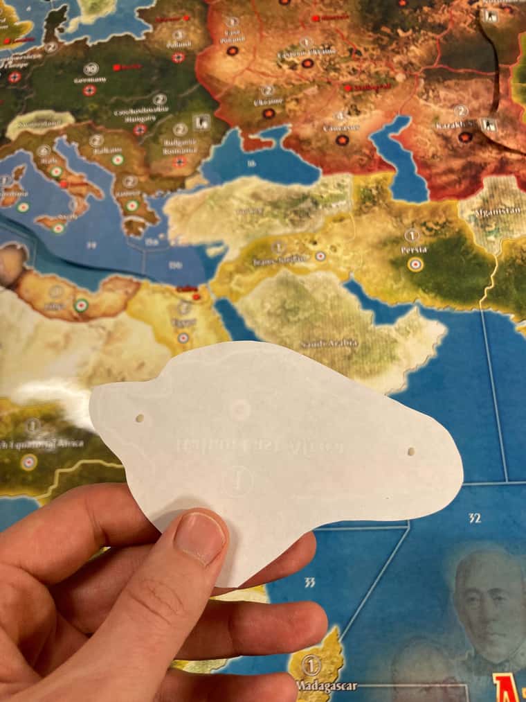
I’ve got my high-quality printout of Tjoek’s file under a 1/8” acrylic sheet, and printouts of some overlays @ 300 DPI. I used tiny pieces of poster putty for each overlay to keep them where I want them and also to allow easy removal without damaging the map/board beneath. Here are some pics of that process:
First we print and cutout the overlays we want. We only need to keep the parts that will cover up the previous map info and make the desired change(s) to the board:

IEA front:

IEA reverse side, with two tiny bits of poster putty shown - about to do gown on the printout:
“After” pic with IEA overlay in place:

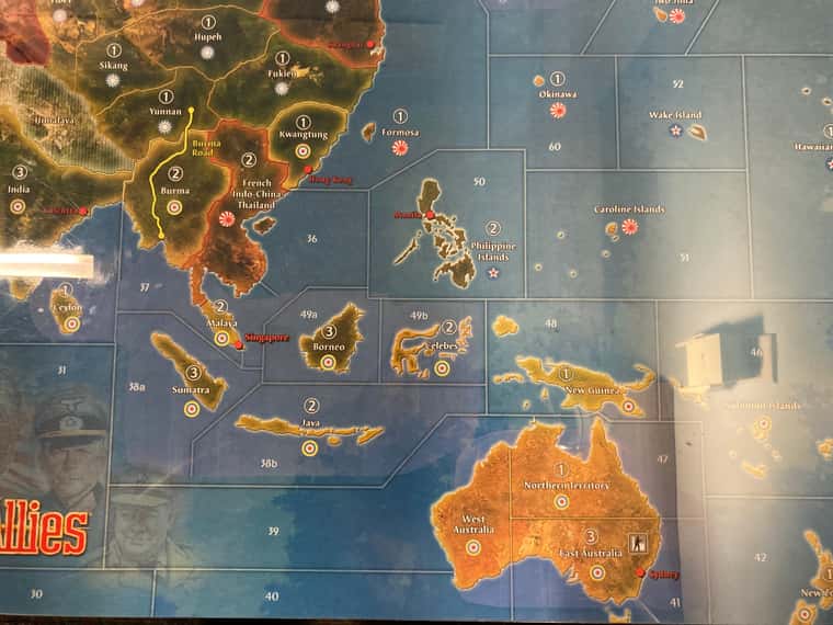
“After” image of Southeast Asia:
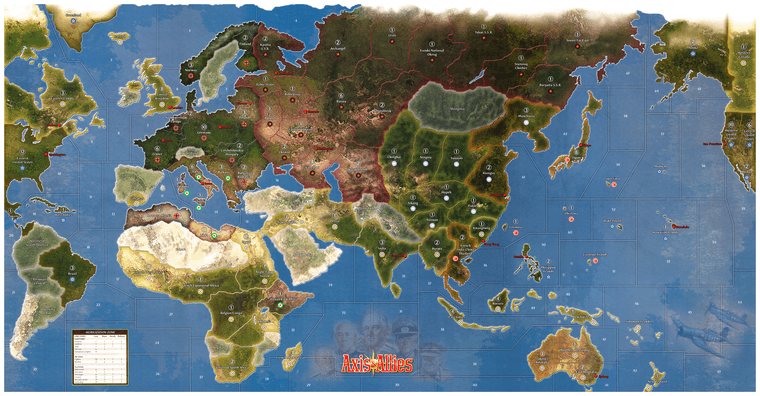
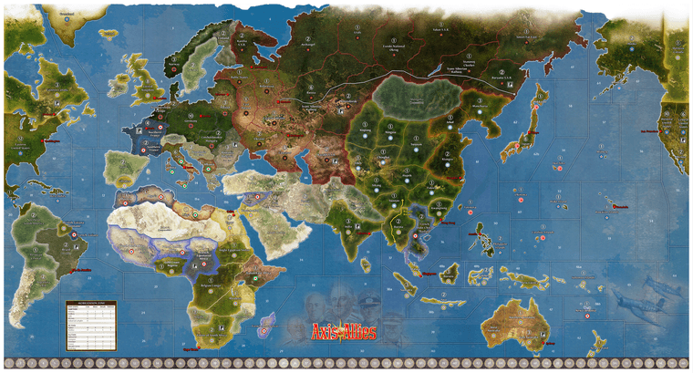
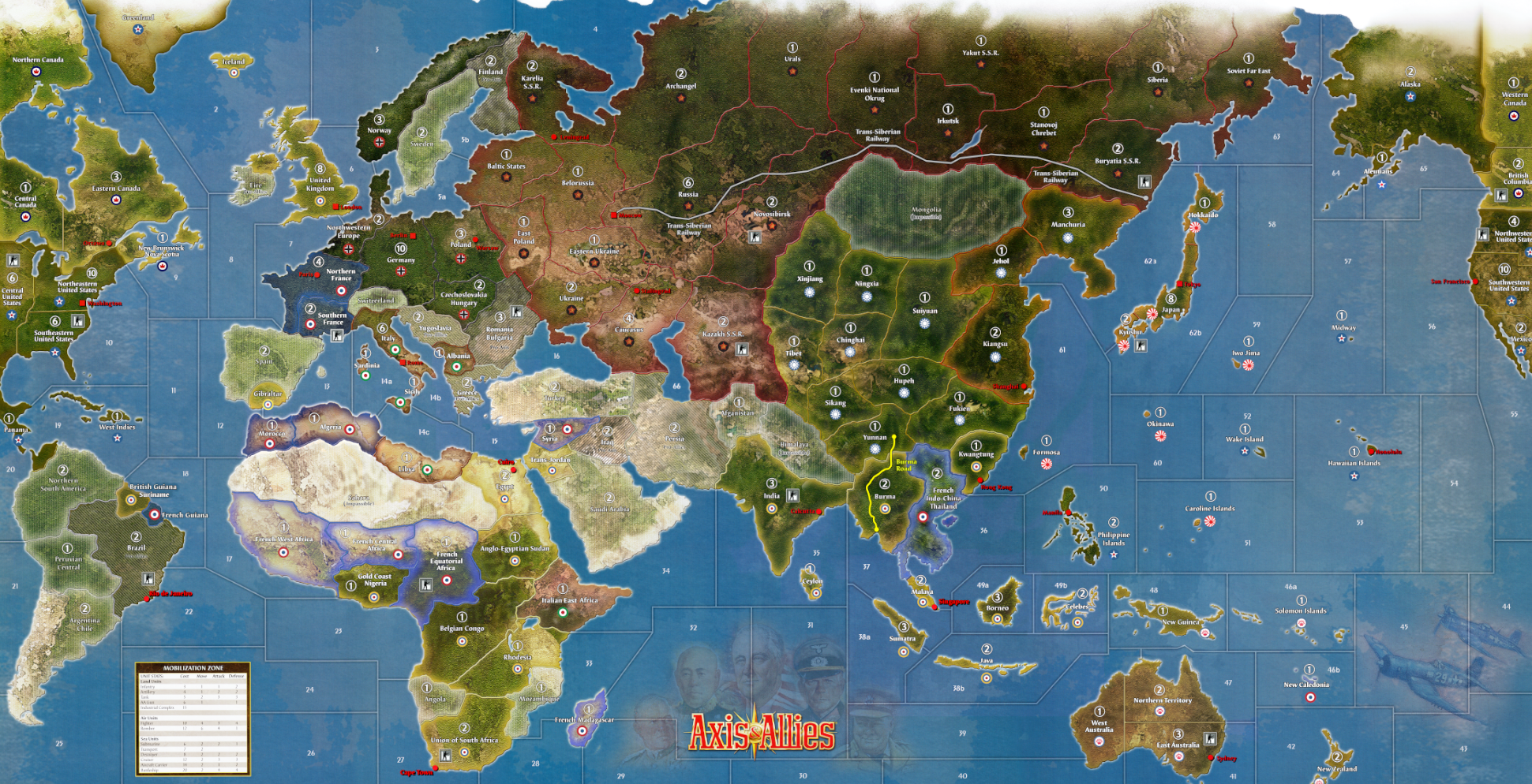
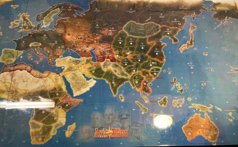
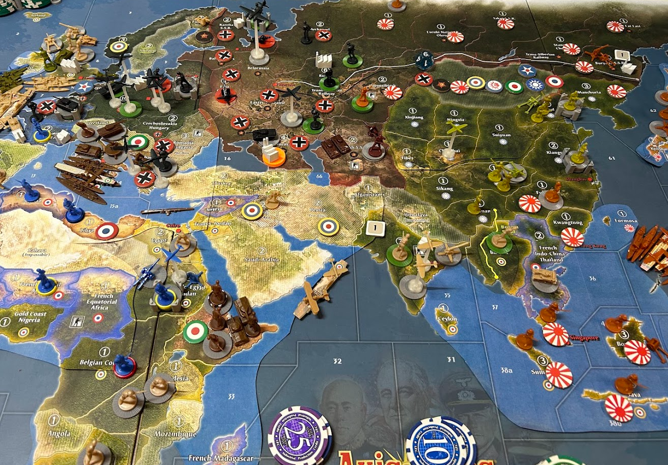
Overview, after applying the overlays:
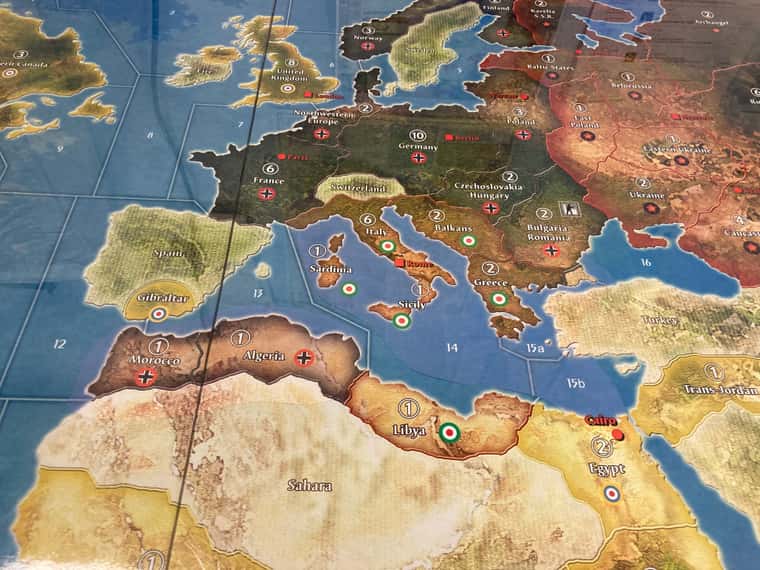
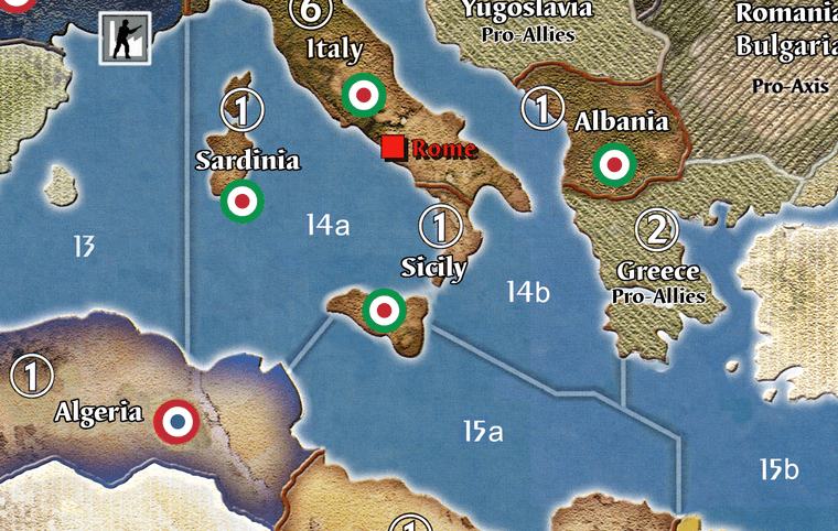
Mediterranean Theater detail:
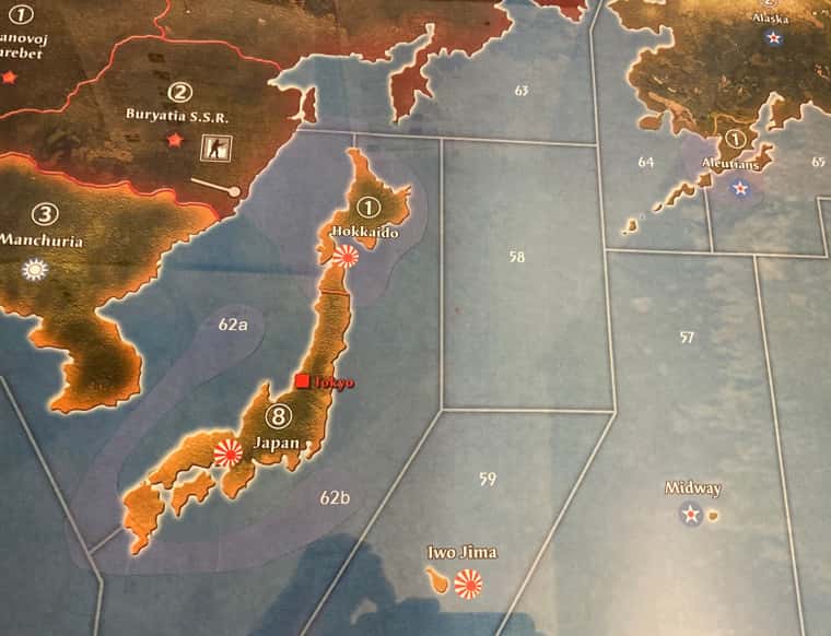
Hokkaido, SZ62 split, Aleutians:
The colors in some cases may be slightly off from your printouts, but at any reasonable distance these overlays really are invisible.
You can also do this on the OOB Board, of course, simply by printing at 400 DPI rather than 300 - see below for some pics at that reduced size.
Because these overlays are much brighter and richer than the OOB board you can either accept the brighter overlay color or try desaturating the overlays first. Personally, I think the brighter overlays make everything easier to read:

“But vodot,” I hear you ask, “overlays are janky and stupid! We want maps!” If you’re looking for full map files that incorporate some or all of these changes, please see the second post below for downloads of full map files and discussion on these.
If there is a particular combination of overlays you’re looking for, post heere and I will see if I can accommodate it.
Index of Overlays:
Pacific Theater:
- New Australia Splits
- Malaya & Singapore
- Celebes redrawn & split off from Borneo
- Java split off from East Indies / Sumatra
- Pacific Sea Zone splits and redraws
- Adding ‘Recruitment Centers’
- Iwo Jima redrawn and Honolulu position fixed
- Pacific & Indian Ocean Island adds and Tweaks:
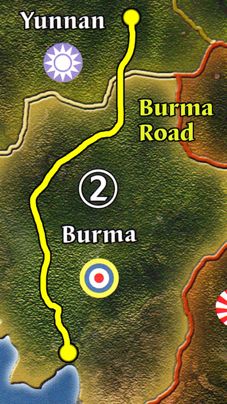
- The Burma Road
- The Trans-Siberian Railroad
- China New Territories
- Japan home island splits
- US West Coast splits
- USSR splits & IPC tweaks
European Theater:
- Italian Islands named IPC-fied
- Italian Africa renamed, recolored, and re-oundeled
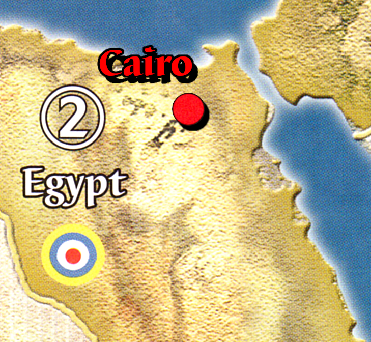
- Cairo!
- Balkan Splits
- North Africa splits
- Turkish border extended north of Bosporus
- Add Rio De Janeiro & Cape Town as VCs
- Fix the Berlin & Warsaw position and wonky OOB borders of Germany/Poland/East Poland
- USA East Coast Splits
- Canada as a Major Power
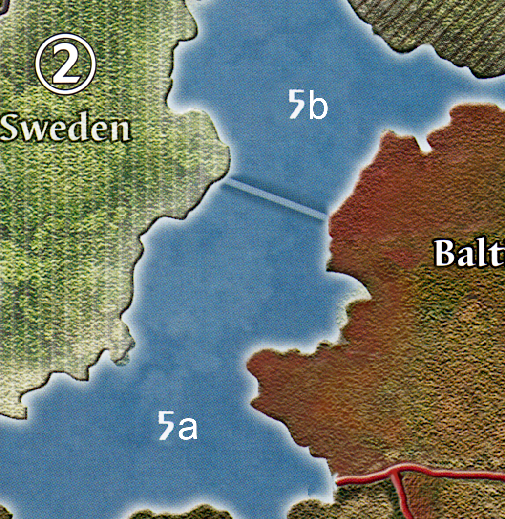
- Baltic Sea (SZ5) Split
- Scotland Split
General Map Tweaks:
- IPC-ification of major Neutrals
- Add “Impassible” text below Mongolia, Switzerland, Sahara, and Himalaya (important if using the “IPC-ified Neutrals” above)
The Actual Overlays:
These are mostly organized in the order of creation, so if you don’t see something you’re looking for please continue to scroll up/down. As this list has grown, it may make more sense to simply download a whole map file and create your own overlays by snipping the parts of it that you like in GIMP/other image editing software.
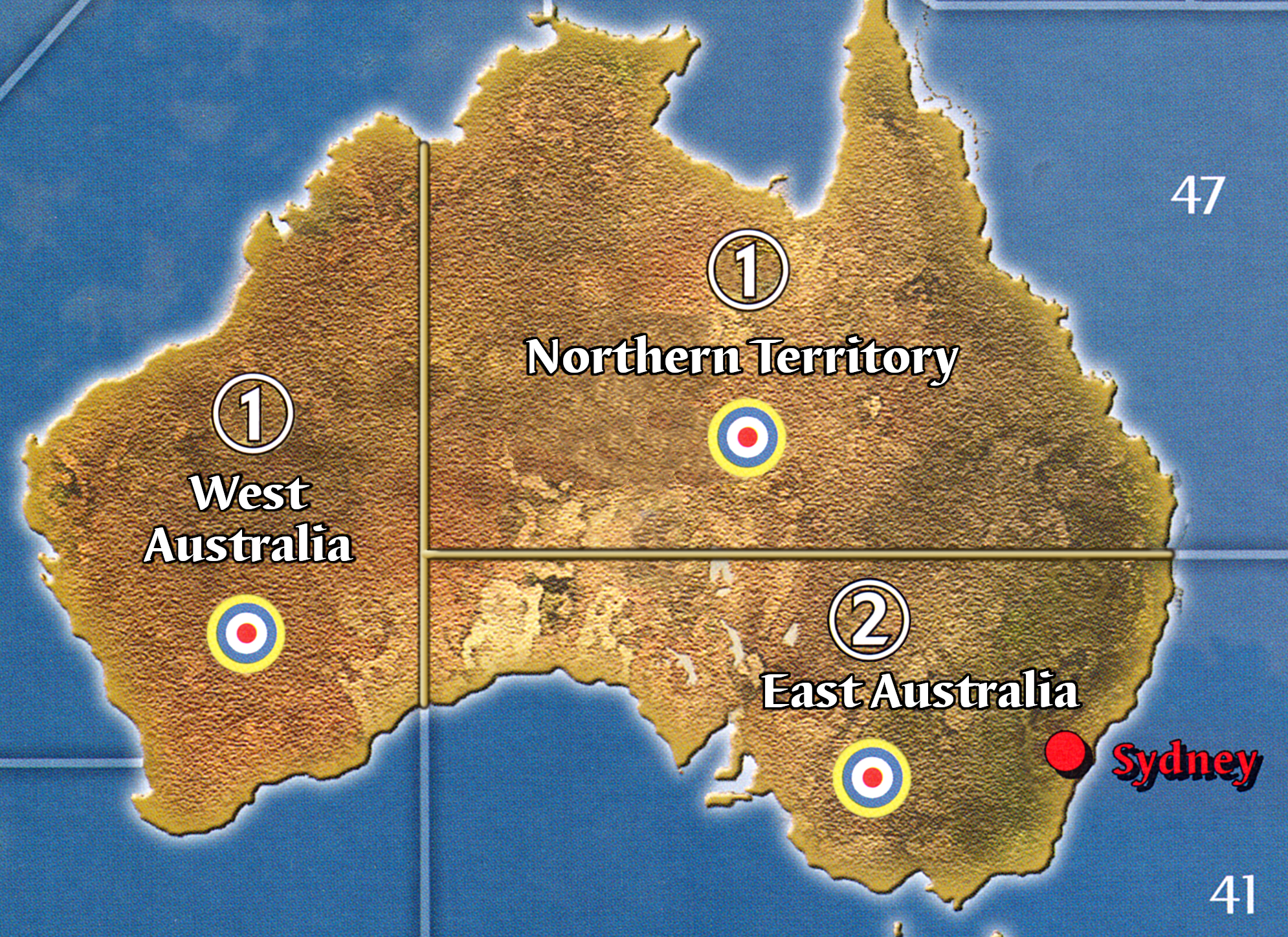
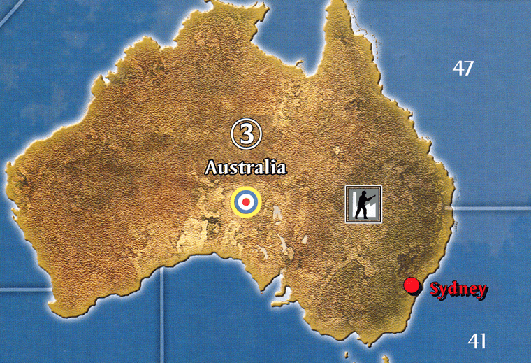
1a. Australia split into East (2) and West (1)

1b. Australia split into East (2), West (1), and North (1)
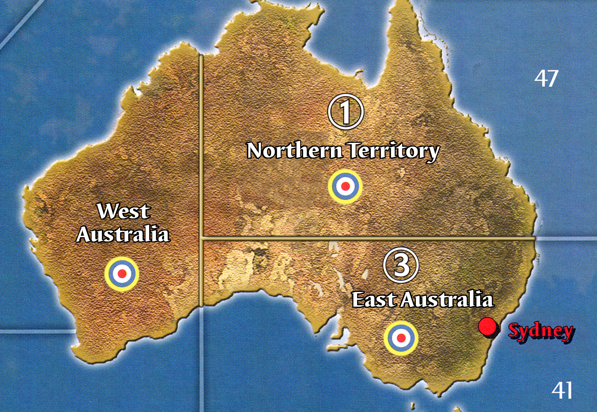
1c. Australia split into East (3), West (0), and North (1)
1c. Australia whole, but worth (3) IPCs

2. Italian islands named and given IPC values

3. Italian East Africa recolored, renamed, and given and Italian roundel

4. Cairo added as a VC
5. Malaya broken off from FICT

6. Singapore added as a VC
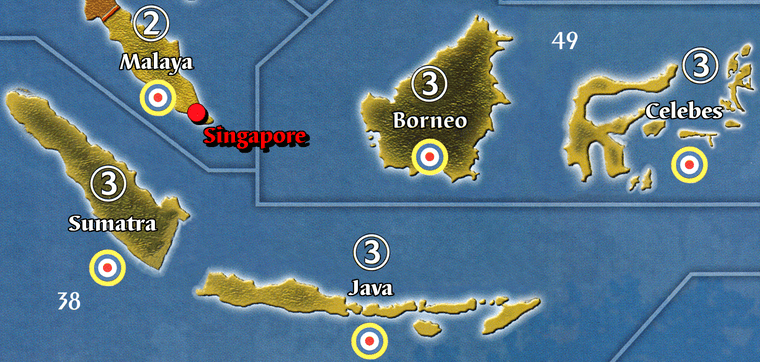
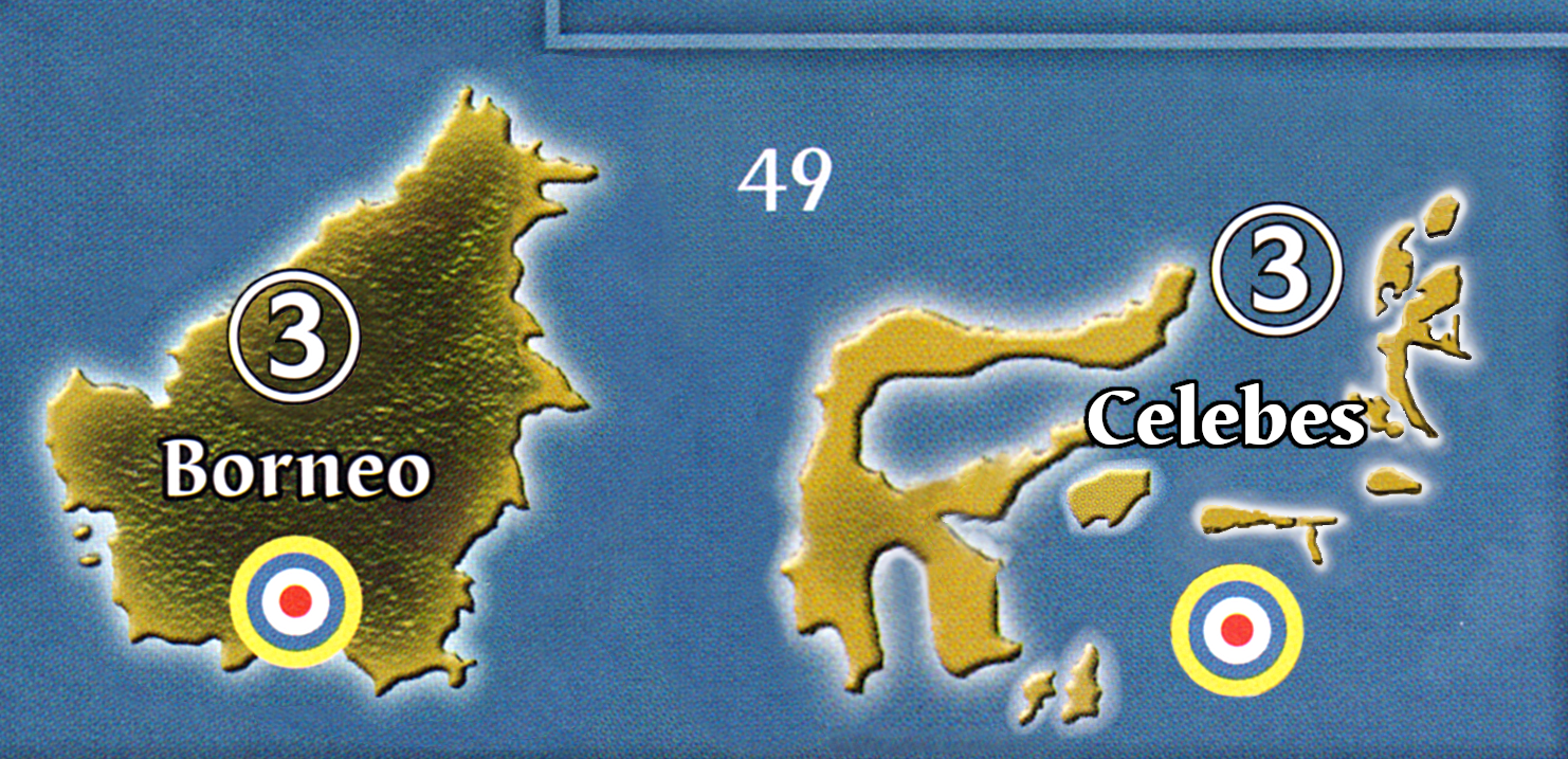
7. Celebes redrawn and broken off from Borneo
8. Java broken off from Sumatra
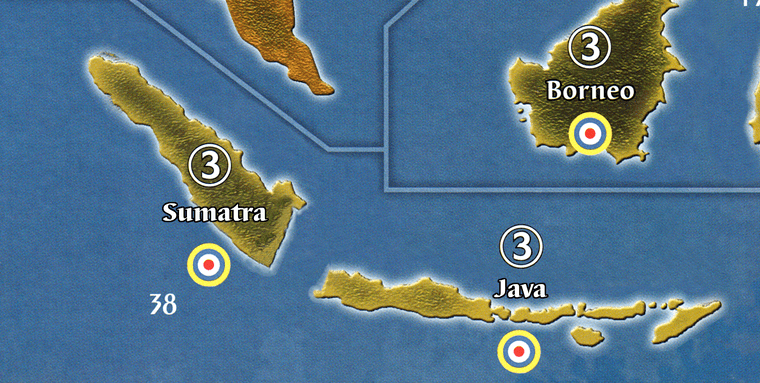
9. Sea Zone splits - 37a/b, 38a/b, & 49a/b

9d. Sea Zone split - 62a/b

10a. Australian RC

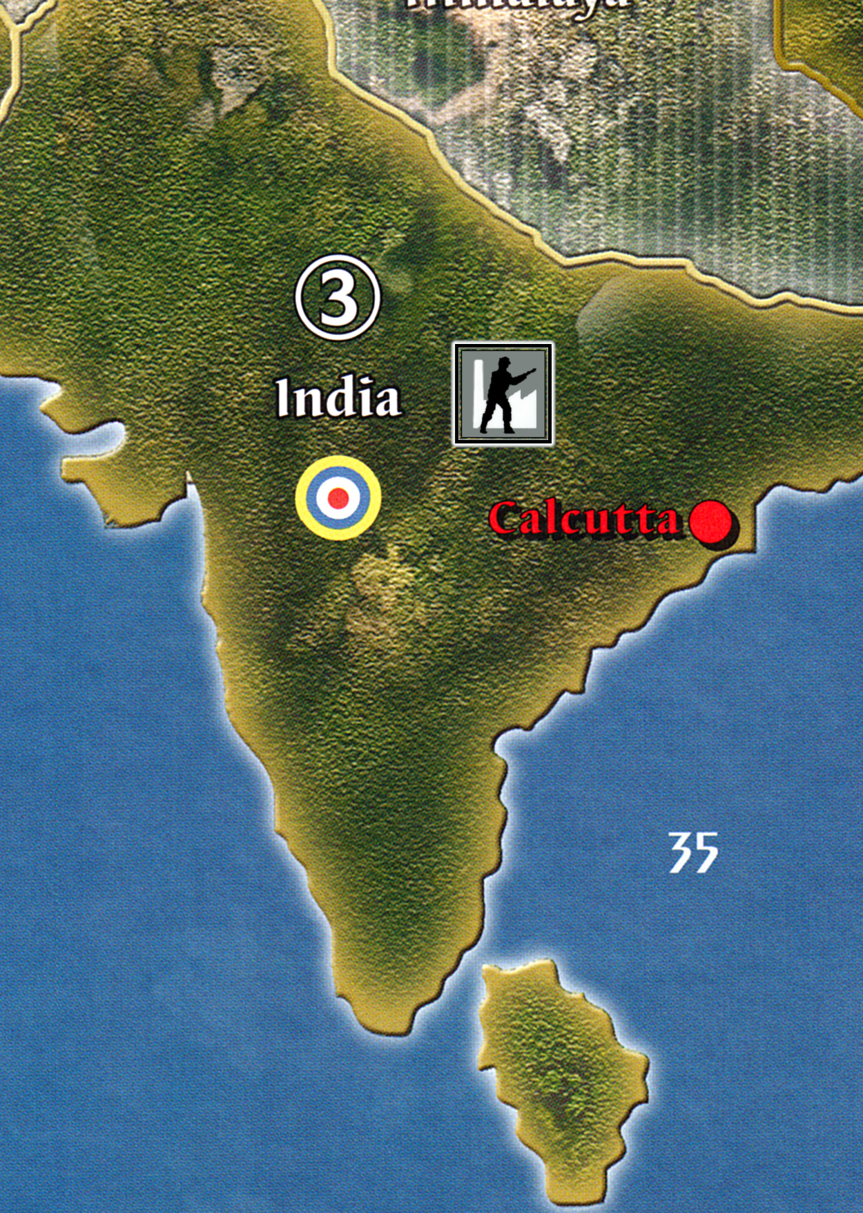
10b. Indian RC
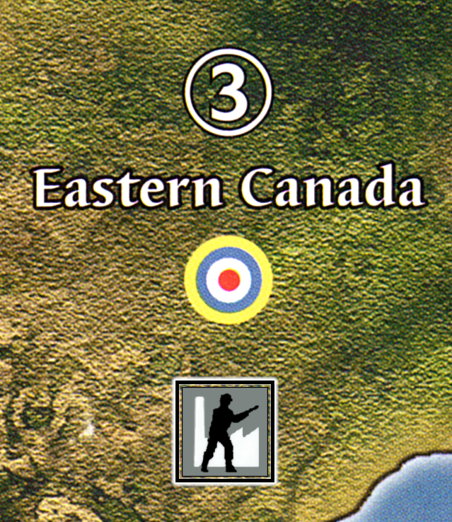
10c. Eastern Canada RC
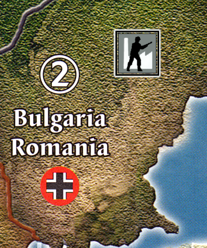
10d. Bulgaria/Romania RC
11. Iwo Jima redrawn and Honolulu fixed

12. Mediterranean Tweaks - Greece, Turkey & Morocco

13. Pacific Island Tweaks - Hokkaido, Kyushu, Aleutians, Midway, Wake, Iwo, and Carolines


Kyushu (2) split off from Japan (reduced to 6):
Kyushu (2) by itself (leaving Japan proper at 8 IPCs):

14 & 15. Ceylon and the Burma Road
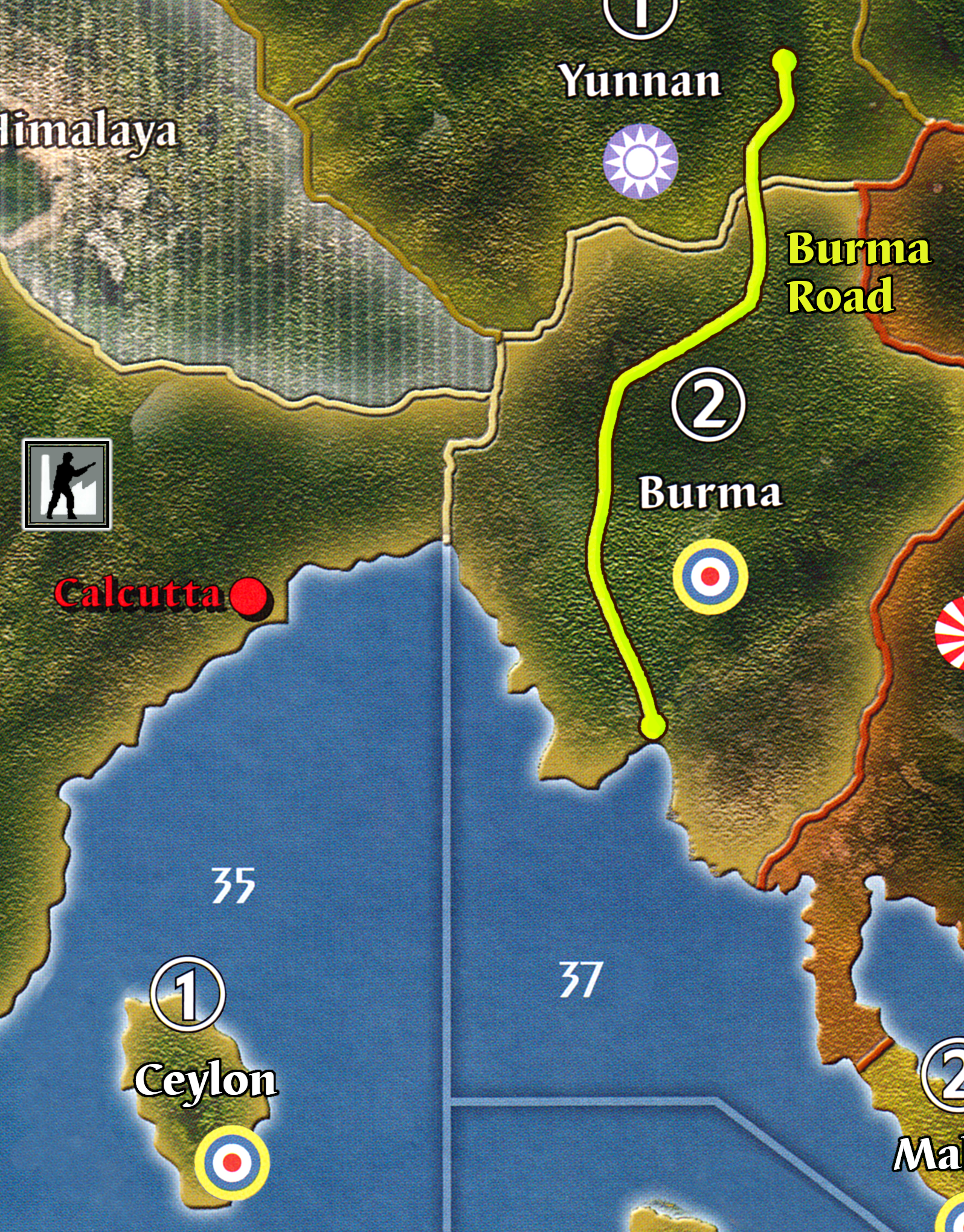
Redrawn Burma Road:
16. NW China additions: Tibet, Xinjiang, Anhwei, and Jehol


Jehol recolored to Chinese:

17. Add Rio & Cape Town as VCs


18. Redraw Melacca Straits

- “Impassible” text added below Mongolia, Switzerland, Sahara, and Himalaya, which becomes important if playable Neutrals are used.

- Playable, IPC-ified Neutrals:
– Sweden (2)
– Turkey (2)
– Saudi Arabia (2)
– Spain (2)
– Argentina Chile (2)
– Afganistan (1)
– South American amalgamations
– Angola (1)
– Mozambique (1)

- Germany/Poland/East Poland geography improvement - border connections remain the same but territories and cities are much closer to actual locations.
 ____
____
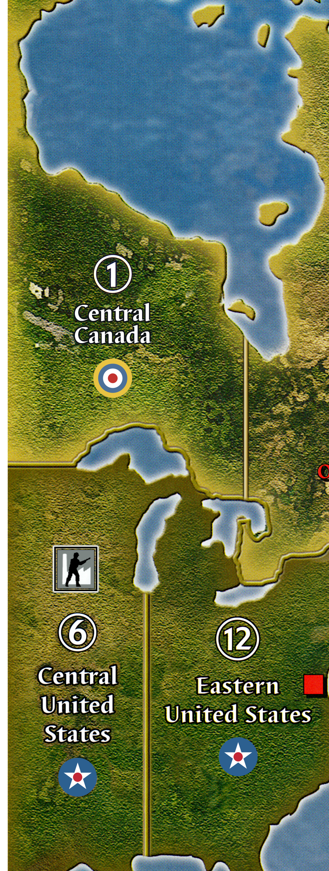
- USA & Canada Tweaks:
- Central US moved to left hand side of map
- Northwestern US (2) split off from [South]western US (10)
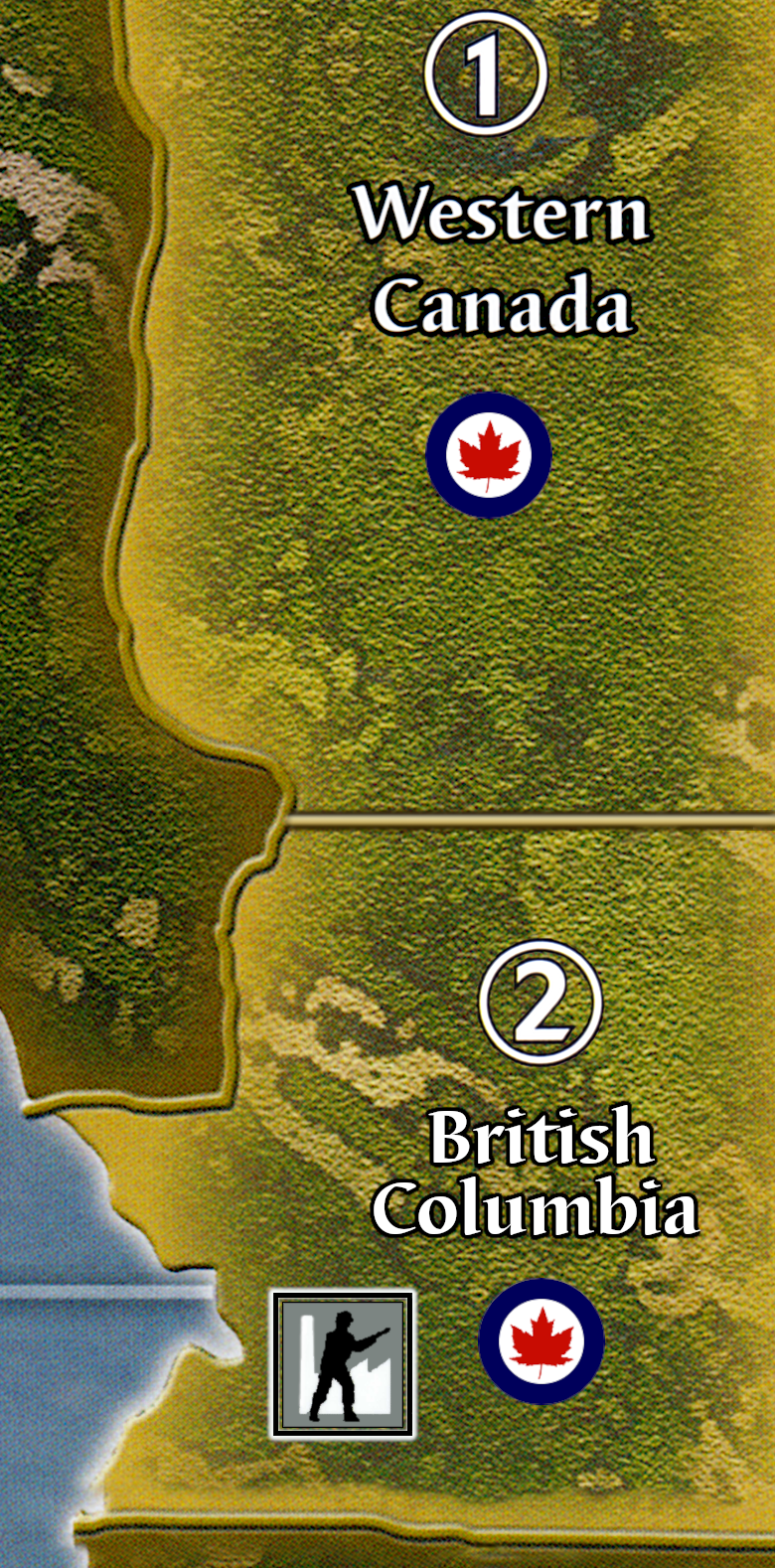
- British Columbia (1) split off from Western Canada (0)
- Eastern US Split into NE and SE
- Central Canada (1) split off from Eastern Canada (1)
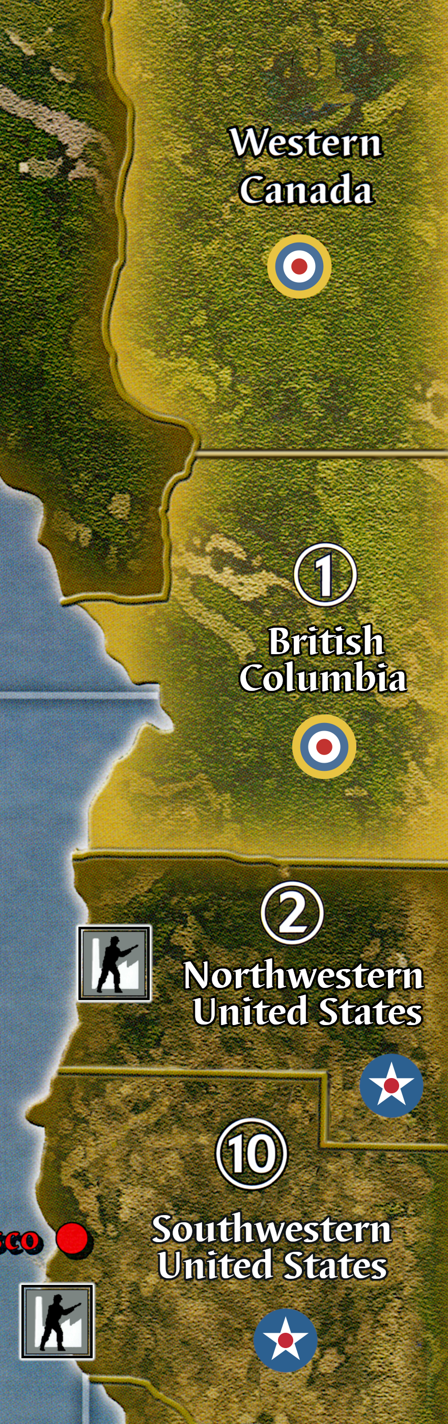

NWUS @ 4 IPC instead of 2:

- Experimenting with new Med SZs:
- Some Soviet tweaks to add a few IPC and granularity:
Split Siberia (1) off from SFE

Split Irkutsk (1) off from Yakut

Net change of +2 for Soviets who have not gotten much from my other tweaks and have fallen somewhat behind in the IPC counts.
- Oh, Canada! Adds Canada as a playable power with 8 IPCs:


- Baltic SZ 5 Split:
- Scotland (2) Split off from UK (6) (or leave at 8).

Thanks for reading and let me know your thoughts!
P.S. One more just for fun :)

Build a sub there, for old time’s sakes :)