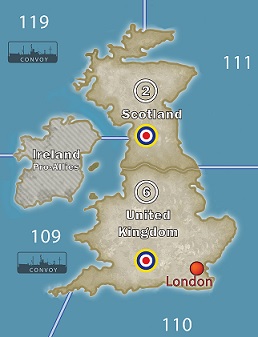
The OOB map is definitely wrong to label the beige northeast corner of the island of Ireland as being part of Scotland – a gaffe that probably annoys the Scots as much as the Irish – and I also find that the map confuses things further by putting a British roundel on top of the straight that separates Ireland from Scotland, thus creating the impression that they are part of a single land mass. So in that respect, Der Kunstler’s customization is quite helpful. I think a further improvement would be to modify Ireland (which DK correctly shows to be an island) to make it look the way the Iberian Peninsula is depicted on the map: much of it consisting of Spain, which is one of the three types of neutrals in the game, but with a British enclave (Gibraltar) in one corner of its territory. “Ireland” is the name of the island as a whole; Eire is the name of the pro-Allied neutral Irish Republic that comprises most (but not all) of the island; and the British northeast corner of the island is called Northern Ireland. That would be strictly speaking the most historically accurate treatment – though not necessarily the optimal treatment in terms of game simplicity.