


@Titus Ah, Okay. Neat setup though!
Cyanight's Customizations
-
Thanks John :)
Yea, its nice to be done but I also feel like its a never-ending project by constantly updating with new pieces. I enjoy adding new pieces and still waiting on HBG’s Amerika and US Expansion set. Hopefully by next year at this time I will have those pieces. I’m looking forward to their French, Italy and German expansions as well but those could be years away.
I did have a problem with the Artillery pieces that I glued to Infantry bases that I cut from old infantry pieces. It seemed the glue did not hold well and the Artillery bases broke off. Any ideas on how to fix that would be great.
Super or gorilla glue, I would think would hold it, like DM was talking about. Other than that I wouldn’t know. :-)
-
-
Hi, it seems like that on “R” and “Q” maps there are some kind of pixel bugs on SZ 92, 94, Turkmenistan, Sikang, Hunan, Kiangsi etc. Those appears to be there when I open maps in Mediafire or paint. “L” and “O” maps are OK.
Nice job anyway! I have to ask an offer for printing one of these babies out.
Thanks for the info, I will check them out
-
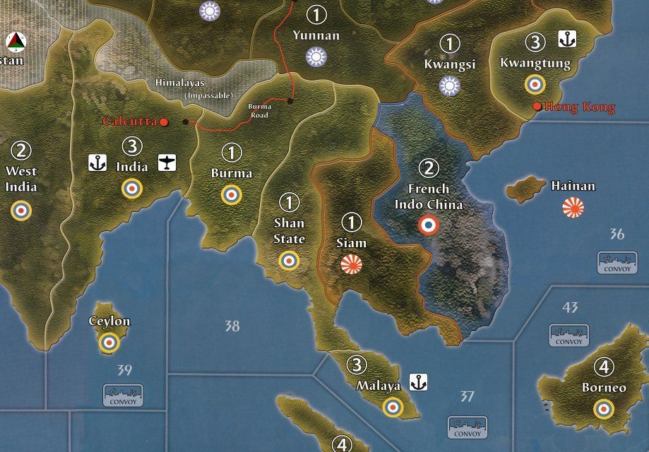
Here is a new map file with the corrections.
http://www.mediafire.com/view/9z56u24ffnzoa2b/A&A_1940_Global_Game_Board_1_S.jpg
-
Below each image is the map file for the associated roundel change. These maps have all the other changes from the previous file. Please review the file before printing since there may be an error that I missed before I posted. Also if you find anything wrong please notify me and I will fix it asap :)
-
Italian Fascist Roundel
-
Neutral Roundels
-
Enlarged English Channel
-
Enlarged Bessarabia
UK Roundel
http://www.mediafire.com/view/9z56u24ffnzoa2b/A&A_1940_Global_Game_Board_1_S.jpgUnion Jack
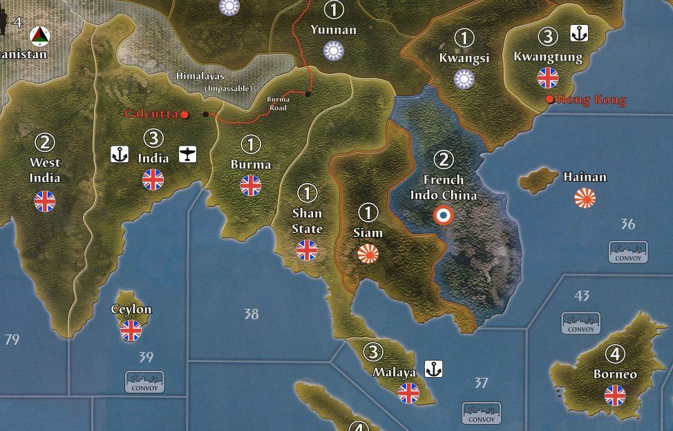
http://www.mediafire.com/view/sri7aqtt6897p13/A%26A%201940%20Global%20Game%20Board_1_U.jpgIndia #1
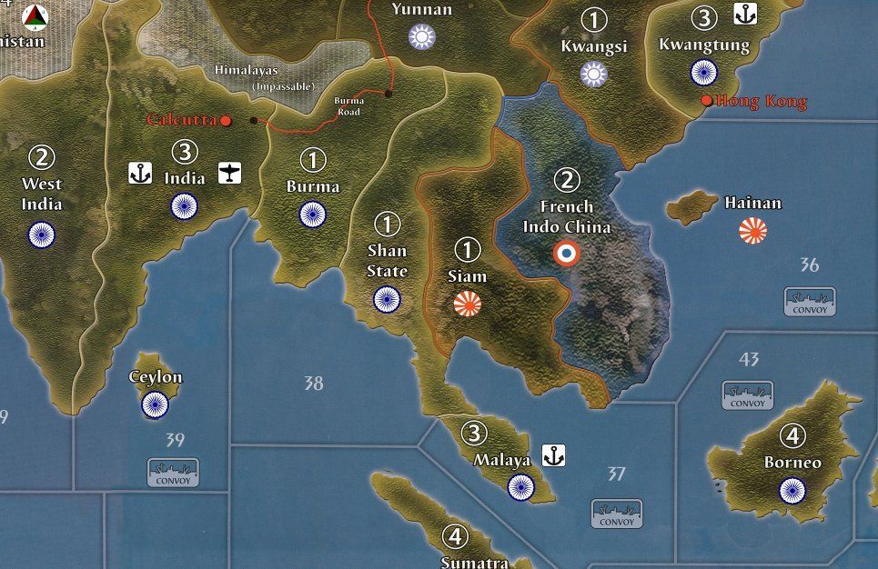
http://www.mediafire.com/view/rcmdrmv0506exs2/A&A_1940_Global_Game_Board_1_V.jpgIndia #2
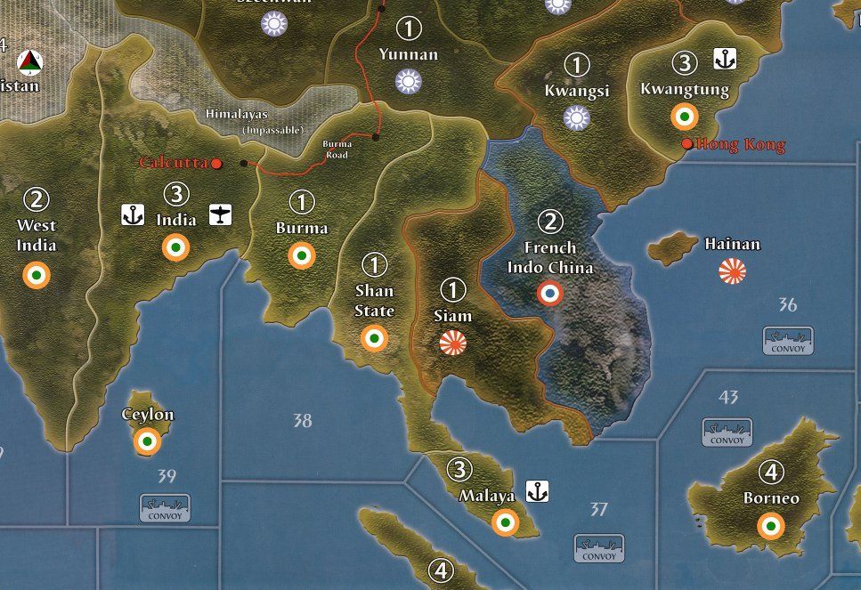
http://www.mediafire.com/view/xa6xr9dpu99x640/A%26A%201940%20Global%20Game%20Board_1_W.jpg -
-
Also if you find anything wrong please notify me and I will fix it asap
I had a quick look and here are a few comments:
-
Very nice map! I especially like the upgraded roundels and the “Adjacent to…” notes on the map edges.
-
Regarding the swastika in Finland: Finland was an Axis co-belligerent but to my knowledge it wasn’t a Nazi or fascist state. Are you using this design to distinguish the Finnish roundel from the one you’re using for Greece?
-
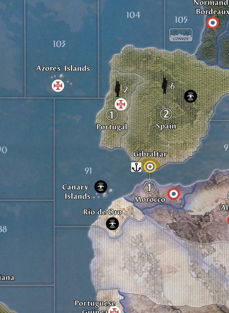
The Spanish roundels in Spain and Rio de Oro appear to be slightly different. Also note that Spain, by June 1940, was ruled by Franco’s Nationalists; I think the roundel shown on the map is the Republican one, though I’m not sure.
-
Why do the Portuguese colonies have distinct roundels rather than common Portuguese ones? The territories of the other colonial powers (Britain, France, the Netherlands, and arguably the US if its territories are viewed as “colonial”) use common roundel designs.
-
Mexico’s two parts should technically have roundels identifying it as a sovereign state (though the problem is that the OOB rules treat them as US territories). Ditto for Central America and the West Indies, which were groups of sovereign states and of colonial holdings. Not sure what the best way to solve this problem would be without bending the rules.
-
-
Very good points Marc.
I used the Blue Swastika for Finland since its Pro-Axis in the game.
I was going to use the Nationalist roundel for Spain but decided to use the Republican one. I can switch that one to the nationalist.
I tried to match the Portuguese colonies with the names on the board. I had no idea they were all supposed to be Portuguese, hehe.
-
Glad the comments were useful. In case it might serve for inspiration purposes, this thread…
http://www.axisandallies.org/forums/index.php?topic=32700.0
…contains nine photos (click on them to expand them) of my customized Global 1940 table, whose customizations chiefly involved roundel modifications. The accompanying text explains the rationale for the various changes.
-
That’s a great reference - So Angola and Mozambique were Portuguese territories?
-
So Angola and Mozambique were Portuguese territories?
Yup. And few other places too that don’t show on the Global map. The Azores were one such place, and in 1943 Portugal allowed the Allies to lease bases there for aircraft and ships, which helped greatly the Allied convoy-protection efforts.
http://en.wikipedia.org/wiki/File:Portuguese_Empire_20th_century.png
-
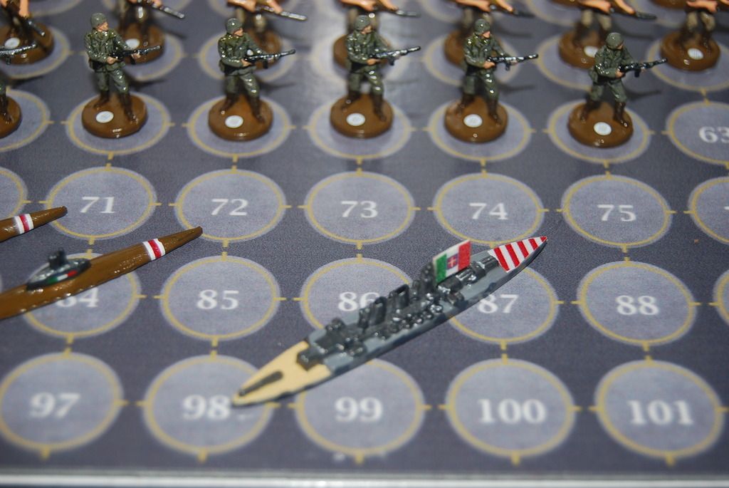
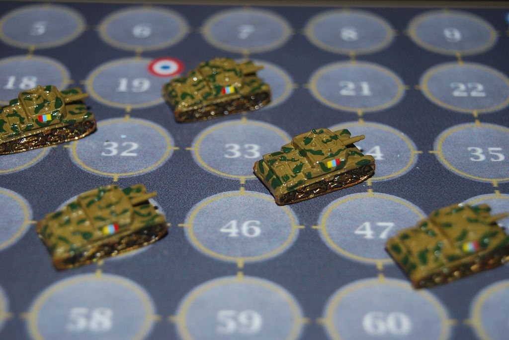
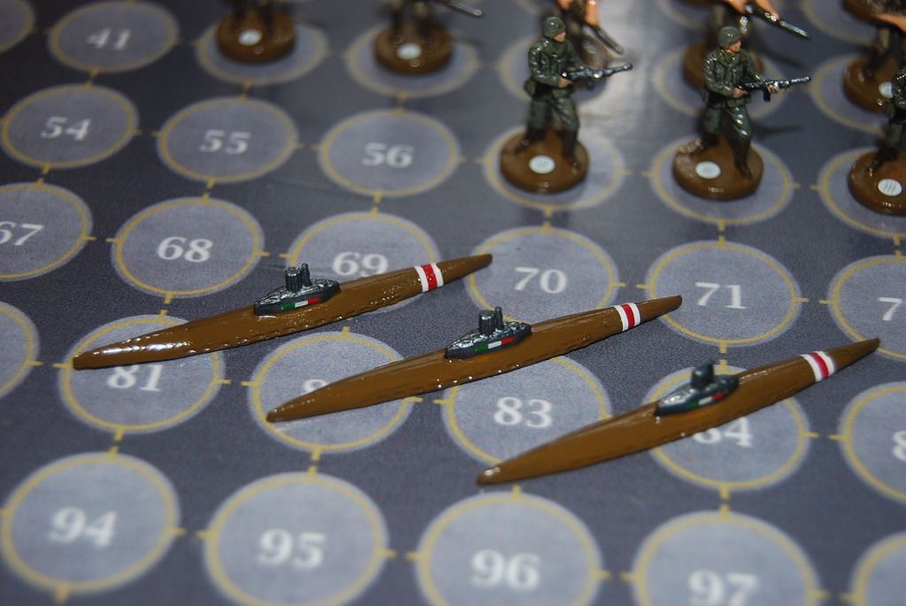
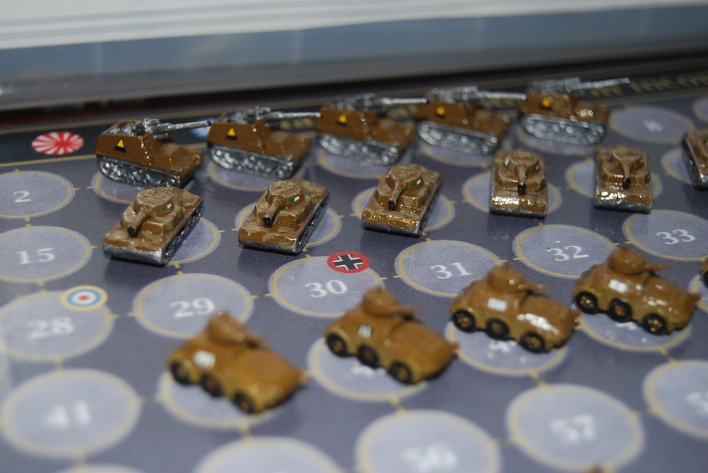
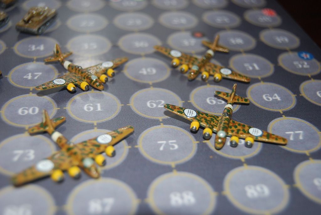
I finally finished my Italian pieces. I wanted to post them when I completed the whole set.
BR-20 Bombers
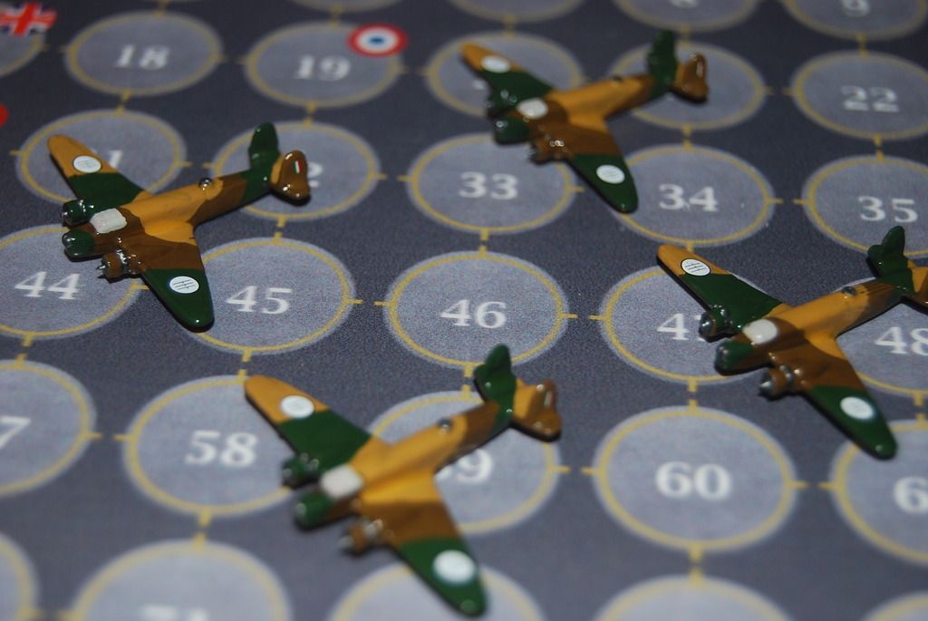
Breda BA 65 Tactical Bomber
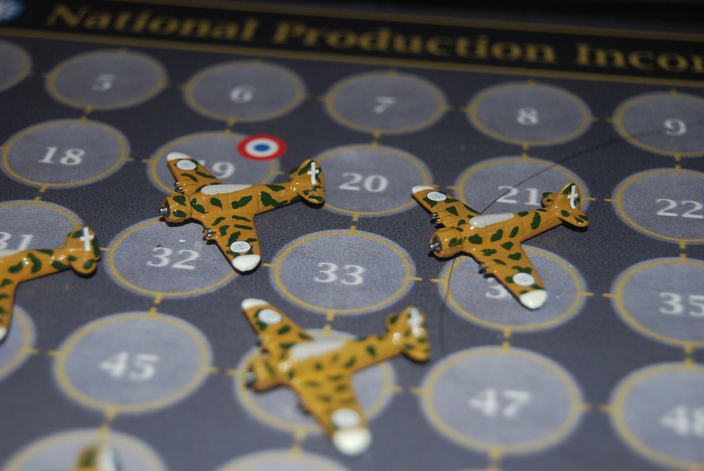
Aquila Class Carrier
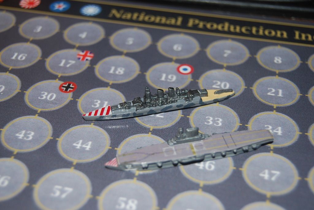
Roma Battleship
Carro Armato 41 Tanks
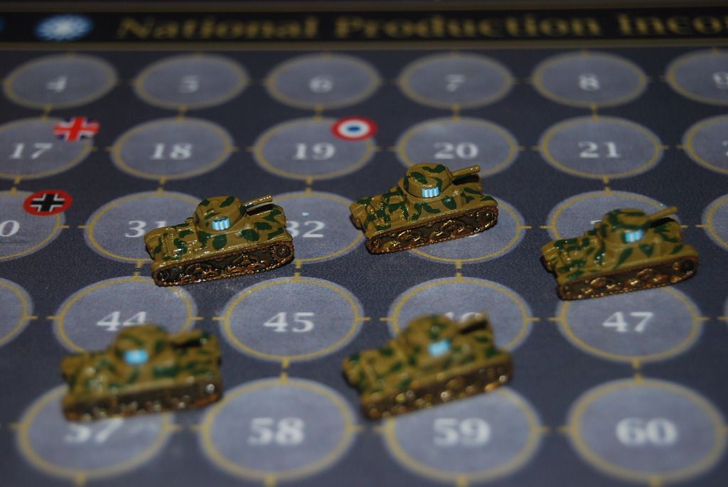
Semovente 105/25 Tank
Infantry, Alpine Infantry
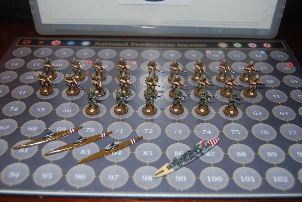
Super Subs
Autoblinda 41 Armoured Cars(Adv Mech), M15/42 Tanks(Heavy Tanks), Hummel (Adv Artillery)
P.108 Heavy Bombers
-
AWESOME!
-
Awesome is right ! Units like that and Italy would have won the war! Really like the subs! Simply Outstanding !
-
Thank you everyone :)
Now that HBG has the Amerika sets I need to get the rust off and start painting again. I feel like its Christmas in July, lol
-
Now that HBG has the Amerika sets I need to get the rust off and start painting again.Â
Do you mean that the HBG Amerika game is finally in stock? I haven’t yet received my pre-order copy.
-
I haven’t received a shipping notice yet either. I saw a post on facebook that they had them in stock and were doing QC on the pieces. I hope that doesn’t take another year, lol
-
I made some more updates to the map from request by another AA member. The first file contains changes to roundels and enlarged capital roundels. The roundels in Africa now are Portugal. Each territory in Persia has a different roundel and Eire, Iraq and Turkey also have new roundels.
The second map contains all the changes in the first map as well as New Zealand roundels for Solomon Islands and New Zealand; New Roundels for Spain and the addition of the Azores and Canary Islands.
http://www.mediafire.com/view/m1oe962p1os59nr/A%26A%201940%20Global%20Game%20Board_1_U_008.jpg
http://www.mediafire.com/view/cmxs60d1arny82p/A%26A%201940%20Global%20Game%20Board_1_RAND_006.jpg -
Big thanks to Cyanight for the map, really happy with it.
Rand
-
Holy cow, Cyanight! I come back from vacation in Colorado, and load and behold, a new painted Italian force emerges. Fantastic paint jobs! I really like your choice in colors.
Great job! :-D
John
-
Thank you so much John. I wondered where you wandered off too, hehe.
Still waiting on Amerika pieces but hopefully I can start painting them soon. I did order some new factories from Shapeways and should have them any day. The new factories have 4 smoke stacks. They will be used for Increased Factory Production Technology.
Minor Factories (one smoke stack) - Production 3
Adv Minor Factories (2 smoke stacks - OOB version) - Production 4
Major Factories (3 - smoke stacks) - Production 10
Adv Major Factories (4 - smoke stacks) - Production 12
Suggested Topics

