


These are great stuff. Thanks for sharing.
May I know more where I could find the rules for the 39 historical edition? I opened the map and it seems there are few more units inside. I am thinking of having the map printed and give that a try :)…
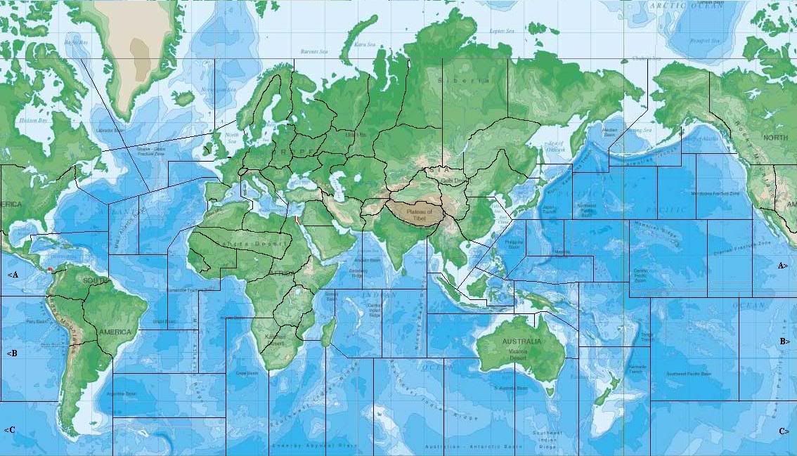
I am in the process of making an enlarged map for AAR. So far I have picked out a World Map and I am marking off all the territories and sea zones using Windows XP Paint. I wanted to make sure I have everying thing correct on the picture before using it as a guide for the final version. Could you please look over what I have done so far and see if I have made any mistakes? THANKS! :-)
I plan on using the following supplies (any additional suggestions would be greatly appreciated):
1 large wall world map.
1 black sharpie for drawing territories.
1 blue sharpie for drawing sea zones.
1 red sharpie for drawing the Suez Canal.
1 pair scissors to cut off the excess from the top and bottom of the map. I will also cut the map to orient it just like the actual game board with the Eastern US on the left side and the Central US/Western US on the right side. Also used to cut out individual country tokens (explained below).
1 roll of clear heavy duty packing tape to tape the modified map together just like the actual game board.
1 scanned and laser color printed sheet of Country Tokens that comes with the game to glue to each initial countries territories.
10 sheets of clear labels to print off territory names, capitols, territory numbers, sea zone numbers, and IPC totals for each territory.
Have final project laminated.
The sea zones are not correct (e.g.atlantic)
Looks correct to me, unless your talking about the shape of the seazone. Although because this is a real map, thats somewhat hard to do.
Yep your right… it just looks weird
I found some mistakes along the Russian/German border. I have corrected those mistakes and updated the map in my initial post. Thanks for the input.
I went ahead and added letters to the sea zones on the outer edges of the map so players wont get confused on which sea zone to move to when moving to the other side of the map.
Im sure you are aware of “elbowmaster” an i correct? He makes similiar maps except he marks them on the map w/o use of a computer. www.elbowmaster.com
Yes I have seen Elbowmasters work (Excellent!). His web site is where I got the idea on where to begin with my map. I would have just ordered one of his maps, but there are some things that I want to do differently, like adding permanent country markers for the initial setup on each territory plus the fact I wanted to save a few bucks by making the map myself.
$15 for the map
$15 for supplies
$30 for lamination
IF you ask him he’ll send you those decals for the icons/airbases etc…Hes a nice chap.
@Imperious:
IF you ask him he’ll send you those decals for the icons/airbases etc…Hes a nice chap.
I will have to do that.
Also, how did you make your map? How big is your map?
My revised is 60 x 36 which is exactly 2 times the size of the original… The other map of 2nd edition is 50x30 which is the same aspect ratio. Other maps i have are 4x3 ,5x4, 6x4,and 8x4
Heres a picture of the map: Note the colors from the printer are not correct. They look exactly like the board.
Very nice, I’ve got to meet up with you for a game some time. I am afraid I will miss dallas again this year, but I may put something together when I get home Arizona is a nice place to visit in the winter…
Yea try to get the thing moved to arizona… its only 4 hours away from me (flagstaff that is)

